| Manassas Regional Airport Harry P. Davis Field | |||||||||||||||
|---|---|---|---|---|---|---|---|---|---|---|---|---|---|---|---|
 | |||||||||||||||
| Summary | |||||||||||||||
| Airport type | Public | ||||||||||||||
| Owner | City of Manassas | ||||||||||||||
| Serves | Manassas, Virginia | ||||||||||||||
| Elevation AMSL | 192 ft / 59 m | ||||||||||||||
| Coordinates | 38°43′17″N 077°30′56″W / 38.72139°N 77.51556°W / 38.72139; -77.51556 | ||||||||||||||
| Website | www.manassasva.gov/airport... | ||||||||||||||
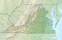
| Map | |||||||||||||||
  | |||||||||||||||
| Runways | |||||||||||||||
| |||||||||||||||
| Statistics (2021) | |||||||||||||||
| |||||||||||||||
| Source: Federal Aviation Administration | |||||||||||||||
Manassas Regional Airport (IATA: MNZ, ICAO: KHEF, FAA LID: HEF), known as Harry P. Davis Field, is 5 mi (8.0 km) southwest of the center of Manassas. Manassas Regional Airport is the largest regional airport in the U.S. state of Virginia. It is located 30 miles (48 km) from Washington, D.C.
History

An airport for Manassas was proposed in 1930, when the mayor was Harry P. Davis. It was built in 1931 on 94 acres (0.38 km) along Virginia Route 234, in the area now known as Manaport Shopping Center. Originally owned privately, the Town of Manassas bought the airport in 1945. Due to airport activity and nearby housing development, the airport moved to its current location in 1964. The new airport opened with a single 3,700-by-100-foot (1,128 m × 30 m) paved runway. In 1992, the city purchased a control tower from Centennial Airport near Denver and reassembled it at Manassas Regional Airport. A new terminal was built in 1996. The IATA code was changed from WOU to the current MNZ between mid-1976 and mid-1977.
The airport saw commercial airline service by Colgan Airways in the 1970s and 1980s with flights to Washington Dulles International Airport and continuing onto Binghamton, NY. Colgan was based at the Manassas airport and flew Beechcraft 99 and Beechcraft 1900 commuter aircraft. From late 1985 through early 1987 Colgan teamed up with New York Air and was known as New York Air Connection providing feeder flights for the larger carrier. In early 1987 New York Air merged into Continental Airlines and Colgan operated as a Continental Express feeder carrier however service to Manassas ended a short time later. Colgan returned to Manassas for a period of time in the mid 1990s operating under their own brand and providing flights to Washington Dulles.
In June 2023, the airport received a proposal from airport operator Avports to relaunch commercial operations, with "multiple interested parties." The Manassas City Council approved the proposal unanimously on July 24, 2023, with commercial operations expected in two years.
Facilities
The airport covers 888 acres (359 ha) at an elevation of 192 feet (59 m). It has two asphalt runways: 16L/34R is 6,200 x 100 feet (1,737 x 30 m) and 16R/34L is 3,715 x 75 feet (1,132 x 29 m).
In the year ending December 31, 2021 the airport had 87,900 aircraft operations, average 241 per day: 98% general aviation, 1% air taxi and 1% military. 374 aircraft were then based at this airport: 287 single-engine aircraft, 46 multi-engine aircraft, 24 jets, and 17 helicopters.
Manassas houses 26 businesses operating onsite ranging from maintenance, flight schools, aircraft charter, and avionics. APP Jet Center and Chantilly Air are the airport's two fixed base operators(FBOs) with Chantilly Air opening in March, 2021. Dulles Aviation had previously run the 1st FBO at the airport from the 1980s until closing its doors in May 2019 and was responsible for a lot of the airport's growth.
One operator at the airport is Quest Diagnostics, who operate PC-12s and TBM 700s at the airfield. Quest Diagnostics specialize in transporting medical samples and tests across the US. They grew massively during the COVID-19 pandemic as the need for rapid transportation of COVID tests and specimens grew exponentially.
See also
- Broad Run/Airport (VRE station)
- Colgan Air (headquarters formerly located on airport grounds)
- City of Manassas
References
- ^ Great Circle Mapper (IATA: MNZ)
- ^ "Airline and Airport Code Search". IATA. Retrieved 12 November 2015.
- ^ FAA Airport Form 5010 for HEF PDF, effective 2023-07-13
- "Manassas Airport Dedication Is Set: State and Federal Officials to Attend Ceremony on Wednesday". The Washington Post. June 5, 1932. p. 8. ProQuest 150345581.
- "Manassas Airport to Be Begun Soon: Citizens Buy 94 Acres for Emergency Landing". The Washington Post. June 16, 1931. p. 22. ProQuest 150228975.
- "Leased Airport Is Purchased By Manassas". The Washington Post. October 21, 1945. p. M3. ProQuest 151778685.
- Airport History at City of Manassas website
- Official Airline Guide
- "New Airport in the D.C. Area? Manassas Airport Eyes Commercial Service in Two Years". AeroXplorer. Retrieved 21 July 2023.
- FAA
- To test during a pandemic, it takes an airline, vol. Video, YouTube: Washington Post, 2020-06-20, retrieved 2023-08-22
- Staff, Ars (2020-04-29). "Appearing nightly, the Quest Diagnostics Air Force". Ars Technica. Retrieved 2023-08-22.
External links
- https://web.archive.org/web/20150209203757/http://www.aviationacrossamerica.com/manassas-regional-airport-celebrates-50-years/
- Manassas Regional Airport at City of Manassas website
- Bussmann Aviation
- FAA Airport Diagram (PDF), effective December 26, 2024
- FAA Terminal Procedures for HEF, effective December 26, 2024
- Resources for this airport:
- FAA airport information for HEF
- AirNav airport information for KHEF
- ASN accident history for HEF
- FlightAware airport information and live flight tracker
- NOAA/NWS weather observations: current, past three days
- SkyVector aeronautical chart, Terminal Procedures
| Administration |
|  | |||
|---|---|---|---|---|---|
| Organizations | |||||
| Landmarks | |||||
| Transportation | |||||
| Culture |
| ||||
| Education | |||||
| Airports in the Baltimore-Washington area | |
|---|---|
| International | |
| Domestic | |
| Federal | |
| General aviation (tower) | |
| General aviation (non-tower) | |
| Historical | |