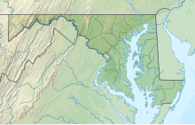
38°36′02″N 077°04′23″W / 38.60056°N 77.07306°W / 38.60056; -77.07306
Airport| Maryland Airport | |||||||||||
|---|---|---|---|---|---|---|---|---|---|---|---|
| Summary | |||||||||||
| Airport type | Public | ||||||||||
| Owner | PSM Holdings, LLC. | ||||||||||
| Operator | PSM Holdings, LLC. | ||||||||||
| Serves | Indian Head, Maryland | ||||||||||
| Elevation AMSL | 175 ft / 53 m | ||||||||||
| Map | |||||||||||
  | |||||||||||
| Runways | |||||||||||
| |||||||||||
| Statistics (2023) | |||||||||||
| |||||||||||
| Source: Federal Aviation Administration | |||||||||||
Maryland Airport (FAA LID: 2W5) is a privately owned, public use airport located four miles (6 km) east of the central business district of Indian Head, in Charles County, Maryland, United States.
Facilities and aircraft
Maryland Airport covers an area of 314 acres (127 ha) which contains one operational runway: 2/20 with a 3,740 x 75 ft asphalt surface.
For the 12-month period ending September 13, 2023, the airport had 22,050 aircraft operations, an average of 60 per day: 98% general aviation, 2% military and <1% air taxi.
Phase 3 of the airport's expansion will include extending the runway to 4,300 feet, along with construction of a parallel taxiway, a ramp to accommodate 75 planes, an access road to Bumpy Oak Road, and a new terminal.
See also
References
- ^ FAA Airport Form 5010 for 2W5 PDF, effective April 18, 2024.
- "After years on runway, airport project takes to sky". www.somdnews.com. Archived from the original on 2014-04-15.
External links
- Maryland Airport at Maryland Office of Regional Aviation Assistance
- Resources for this airport:
- FAA airport information for 2W5
- AirNav airport information for 2W5
- FlightAware airport information and live flight tracker
- SkyVector aeronautical chart for 2W5
This article about an airport in Maryland is a stub. You can help Misplaced Pages by expanding it. |