  | |
| Etymology | PS Clonmel |
|---|---|
| Geography | |
| Location | Bass Strait |
| Coordinates | 38°42′42″S 146°42′16″E / 38.7115278°S 146.7045833°E / -38.7115278; 146.7045833 |
| Administration | |
| Australia | |
| State | Victoria |
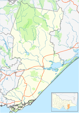
Clonmel Island is a sand island in Corner Inlet, in the Gippsland region of Victoria, Australia. Clonmel Island lies within the Nooramunga Marine and Coastal Park and is a part of a complex of barrier islands that protect a large marine embayment from the pounding waves of Bass Strait.
History
The island is named after the paddle steamer PS Clonmel which was wrecked in the Port Albert Entrance to Corner Inlet, immediately east of the island, in 1841.
References
- "Nooramunga and Corner Inlet Marine and Coastal Parks" (PDF), Park Notes, Parks Victoria, August 2012, retrieved 11 April 2015
- "PS Clonmel Victorian Heritage Register (VHR) Number S129". Victorian Heritage Database. Heritage Victoria.
| Islands and islets of Victoria, Australia | |
|---|---|
| Near East Gippsland | |
| Near Corner Inlet | |
| Near Wilsons Promontory | |
| In Western Port | |
| In Port Phillip | |
| Near Portland Bay | |
| In rivers | |
This article about a location in Gippsland (region) is a stub. You can help Misplaced Pages by expanding it. |