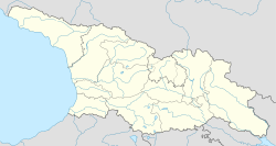
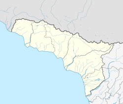
| Zegani ზეგანი (Georgian) | |
|---|---|
| Village | |
  | |
| Coordinates: 43°27′01″N 40°08′58″E / 43.45028°N 40.14944°E / 43.45028; 40.14944 | |
| Country | |
| Partially recognized independent country | |
| District | Gagra |
| Community | Mekhadiri |
| Elevation | 520 m (1,710 ft) |
| Population | |
| • Total | 90 |
| Time zone | UTC+4 (GET) |
Zegani (Georgian: ზეგანი) is a village at an altitude of 320 meters from sea level in the Gagra District of Abkhazia, Georgia, 34 kilometres (21 mi) from Gagra. It is noted for its monastery complex, featuring a triple basilica.
History and demographics
In 1959, there were 209 people living in the village, mainly Armenians. By the 1989 census, the village had 90 inhabitants, again mostly Armenians.
Geography
Zegani lies to the southwest of Akvaskia and southwest of Ochamchire, 34 kilometres (21 mi) from Gagra. The Alazani River flows in the vicinity. Akuasnia Railway Station lies to the southeast. The area between the village and the Ochamchire-Tkvarceli Road to the east is forested.
Architecture
Zegani is noted for its monastery complex, and features a basilica with three churches, dedicated to the Virgin ("Kvela Tsminda"). The Church of Our Lady measures 28.5 metres (94 ft) in overall length.
See also
Notes
- The political status of Abkhazia is disputed. Having unilaterally declared independence from Georgia in 1992, Abkhazia is formally recognised as an independent state by 5 UN member states (two other states previously recognised it but then withdrew their recognition), while the remainder of the international community recognizes it as de jure Georgian territory. Georgia continues to claim the area as its own territory, designating it as Russian-occupied territory.
Literature
- Georgian Soviet Encyclopedia, V. 4, p. 493, Tb., 1979.
References
- The political status of Abkhazia is disputed. Having unilaterally declared independence from Georgia in 1992, Abkhazia is formally recognised as an independent state by 5 UN member states (two other states previously recognised it but then withdrew their recognition), while the remainder of the international community recognizes it as de jure Georgian territory. Georgia continues to claim the area as its own territory, designating it as Russian-occupied territory.
- 1989 Abkhazia Census
- Этнокарта Абхазской АССР 1959, ethno-kavkaz.narod.ru
- Всесоюзная перепись населения 1989. Абхазская АССР, pop-stat.mashke.org
- ^ "Zegani" (Map). Google Maps. Retrieved 30 January 2020.
- Works Issued by the Hakluyt Society. Hakluyt Society. 1970. p. 343. ISBN 9780521010290.
- Tania Velmans; Adriano Alpago Novello (1996). L' Arte della Georgia: affreschi e architetture (in Italian). Jaca Book. ISBN 9788816601925.
- David Marshall Lang (1966). "The Georgians, Ancient Peoples and Places". p. 127.
| Mekhadiri Community | |
|---|---|
| See also: Subdivisions of Georgia |
| Gagra District | |||||||
|---|---|---|---|---|---|---|---|
| Municipalities |
| ||||||
| Other populated places | |||||||
| See also: Subdivisions of Abkhazia | |||||||