| Zalemenga Залеменьга | |
|---|---|
| Selo | |
  | |
| Coordinates: 61°30′N 41°53′E / 61.500°N 41.883°E / 61.500; 41.883 | |
| Country | Russia |
| Region | Arkhangelsk Oblast |
| District | Velsky District |
| Time zone | UTC+3:00 |
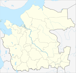
Zalemenga (Russian: Залеменьга) is a rural locality (a selo) in Lipovskoye Rural Settlement of Velsky District, Arkhangelsk Oblast, Russia. The population was 33 as of 2014. There are 3 streets.
Geography
Zalemenga is located on the Puya River, 97 km north of Velsk (the district's administrative centre) by road. Malaya Lipovka is the nearest rural locality.
References
- Карта деревни Залеменьга в Архангельской области
- Паспорта населённых пунктов муниципального образования «Вельский муниципальный район» по состоянию на 1 января 2014 года
- Расстояние от Залеменьги до Вельска
This Arkhangelsk Oblast location article is a stub. You can help Misplaced Pages by expanding it. |