| Xojeli Karakalpak: Xojeli/Хожели | |
|---|---|
| City | |
 | |
 | |
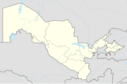
| Coordinates: 42°24′N 59°27′E / 42.400°N 59.450°E / 42.400; 59.450 | |
| Country | |
| Autonomous Republic | Karakalpakstan |
| District | Xojeli district |
| Population | |
| • Total | 67,800 |
| Time zone | UTC+5 (UZT) |
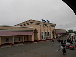
Xojeli, also Khodzheyli (Karakalpak: Xojeli/Хожели,[xoˈʒeli]; Russian: Ходжейли, romanized: Khodzheyli), is a city and seat of Xojeli District in Karakalpakstan in Uzbekistan. It lies 15 km southwest of Nukus, and 25 km northeast of Konye-Urgench (Turkmenistan). Its population is 67,800 (2016). Xojeli has a railway station on the line from Atyrau (western Kazakhstan) to Tashkent.
There is an ancient city and archaelogical complex called Mizdarkhan, located northeast of Xojeli, which consists of several medieval and ancient archaeological sites as: underground Mausoleum of Nazlymhan Sulu, Mausoleum of Shamun Naby (a Sufi scholar), Medrese of Erezhep Halifa and Hill of Zhomart Kassap (ancient Zoroastrian dakhma). Nowadays, Mizdarkhan functions also as a graveyard and people in Karakalpakstan visit on pilgrimage.
References
- "Classification system of territorial units of the Republic of Uzbekistan" (in Uzbek and Russian). The State Committee of the Republic of Uzbekistan on statistics. July 2020.
- Soliyev, A.S. Shaharlar geografiyasi [Geography of cities] (PDF) (in Uzbek). p. 143.
- Uzbekistan Railways timetable
| Karakalpakstan | ||
|---|---|---|
| Capital: Nukus | ||
| Districts |  | |
| Cities | ||
| Towns | ||
This Uzbekistan location article is a stub. You can help Misplaced Pages by expanding it. |