| Wyszobór | |
|---|---|
| Village | |
 | |
 | |
| Coordinates: 53°53′12″N 15°19′14″E / 53.88667°N 15.32056°E / 53.88667; 15.32056 | |
| Country | |
| Voivodeship | West Pomeranian |
| County | Gryfice |
| Gmina | Płoty |
| Time zone | UTC+1 (CET) |
| • Summer (DST) | UTC+2 (CEST) |
| Vehicle registration | ZGY |
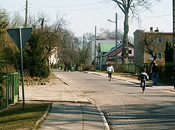
Wyszobór is a village in the administrative district of Gmina Płoty, within Gryfice County, West Pomeranian Voivodeship, in north-western Poland. It lies approximately 10 kilometres (6 mi) north-east of Płoty, 9 km (6 mi) east of Gryfice, and 72 km (45 mi) north-east of the regional capital Szczecin.
History
The territory became part of the emerging Polish state under its first ruler Mieszko I around 967. Following the fragmentation of Poland, it was part of the Duchy of Pomerania.
During World War II, the Germans operated a forced labour subcamp of the prison in Goleniów in the village.
Transport
The Polish S6 highway passes nearby, east of Wyszobór.
References
- "Central Statistical Office (GUS) - TERYT (National Register of Territorial Land Apportionment Journal)" (in Polish). 2008-06-01.
- Labuda, Gerard (1993). "Chrystianizacja Pomorza (X–XIII stulecie)". Studia Gdańskie (in Polish). Vol. IX. Gdańsk-Oliwa. p. 47.
- "Außenkommando des Zuchthauses Gollnow in Wisbu". Bundesarchiv.de (in German). Retrieved 13 December 2023.
This Gryfice County location article is a stub. You can help Misplaced Pages by expanding it. |
