| Villarta de San Juan | |
|---|---|
| Municipality | |
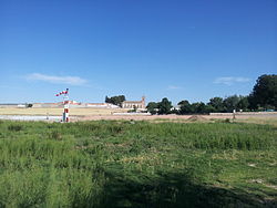
 View of Villarta de San Juan View of Villarta de San Juan | |
 Coat of arms Coat of arms | |
  | |
| Coordinates: 39°14′N 3°25′W / 39.233°N 3.417°W / 39.233; -3.417 | |
| Country | Spain |
| Autonomous community | Castilla–La Mancha |
| Province | Ciudad Real |
| Area | |
| • Total | 66.00 km (25.48 sq mi) |
| Elevation | 626 m (2,054 ft) |
| Population | |
| • Total | 2,845 |
| • Density | 43/km (110/sq mi) |
| Demonym(s) | Villartero, Villartera |
| Time zone | UTC+1 (CET) |
| • Summer (DST) | UTC+2 (CEST) |
| Postal code | 13210 |
Villarta de San Juan is a municipality of Spain belonging to the province of Ciudad Real, in the autonomous community of Castilla–La Mancha.
Housing lies on the left (southern) bank of the Cigüela. It stands on the A-4 route.
Villarta was seemingly settled by the Hospitallers in 1236, perhaps dependant on nearby Arenas de San Juan.
The municipality has a total area of 66.00 km and, as of 1 January 2022, it has a registered population of 2,713.
Notable people
- Tomás Pina (born 1987), professional footballer
References
- Municipal Register of Spain 2018. National Statistics Institute.
- Barquero Goñi, Carlos (1997). "La repoblación hospitalaria en la Corona de Castilla (siglos XII-XVI)" (PDF). Historia. Instituciones. Documentos (24). Seville: Universidad de Sevilla: 75. ISSN 0210-7716.
- "Datos del registro de entidades locales". Ministerio de Asuntos Económicos y Transformación Digital. Retrieved 24 December 2023.
External links
 Media related to Villarta de San Juan at Wikimedia Commons
- Ayuntamiento de Villarta de San Juan
- Ciudad Real Tourism
- Associación Tierra y Agua
- Ruta Don Quijote
This article about a location in the autonomous community of Castilla–La Mancha, Spain is a stub. You can help Misplaced Pages by expanding it. |