| Villa Palmeras | |
|---|---|
| Subbarrio | |
 Street, cars and homes in Villa Palmeras in 2020 Street, cars and homes in Villa Palmeras in 2020 | |
 Villa Palmeras on map of Santurce Villa Palmeras on map of Santurce | |
| Commonwealth | |
| Municipality | |
| Barrio | Santurce |
| Area | |
| • Total | .06 sq mi (0.2 km) |
| • Land | .06 sq mi (0.2 km) |
| Elevation | 0 ft (0 m) |
| Population | |
| • Total | 2,351 |
| • Density | 39,183.3/sq mi (15,128.8/km) |
| Source: 2010 Census | |
| Time zone | UTC−4 (AST) |
Villa Palmeras is one of the forty subbarrios of Santurce, a barrio of San Juan, Puerto Rico.
Demographics
In 2000, Villa Palmeras had a population of 2,648.
In 2010, Villa Palmeras had a population of 2,351 and a population density of 39,183.3 persons per square mile.
Pedro Pierluisi created a political campaign video with residents of Villa Palmeras when he was running for governor in 2015.
The municipality of San Juan provided economic incentives to businesses in Villa Palmeras in the 2010s.
San José Cemetery
The San José Cemetery in Villa Palmeras is the final resting place of many famous Puerto Rican musicians including Rafael Cepeda, Pellín Rodríguez, Tommy Olivencia, Rafael Cortijo, Ismael Rivera and Sammy Ayala of El Gran Combo.
Gallery
-
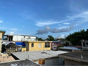
 Villa Palmeras homes view from atop a home
-
 Mural on Calle Loíza in Villa Palmeras in Santurce (a barrio of San Juan), in Puerto Rico
-
 San José Cemetery
See also
References
- ^ Puerto Rico 2010 population and housing unit counts.pdf (PDF). U.S. Dept. of Commerce, Economics and Statistics Administration, U.S. Census Bureau. 2010.
- U.S. Geological Survey Geographic Names Information System: Villa Palmeras Subbarrio
- Puerto Rico 2000: Population and Housing Unit Counts
- Pierluisi, Pedro. "Villa Palmeras". YouTube (in Spanish). Archived from the original on 2021-12-21. Retrieved 16 July 2020.
- Arbasetti, por Joel Cintrón (2018-04-10). "Ganan los grandes comercios con incentivos de la capital". Centro de Periodismo Investigativo (in Spanish). Retrieved 2020-07-16.
- "Peregrinación salsera en el cementerio de Villa Palmeras (galería)". NotiCel (in Spanish). 2015-10-31. Retrieved 2020-08-09.
18°26′44″N 66°02′58″W / 18.44556°N 66.04944°W / 18.44556; -66.04944
This San Juan, Puerto Rico location article is a stub. You can help Misplaced Pages by expanding it. |