Commune in Occitania, France
| Troncens | |
|---|---|
| Commune | |
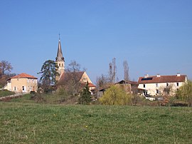
 A general view of Troncens A general view of Troncens | |
| Location of Troncens | |
  | |
| Coordinates: 43°27′41″N 0°12′57″E / 43.4614°N 0.2158°E / 43.4614; 0.2158 | |
| Country | France |
| Region | Occitania |
| Department | Gers |
| Arrondissement | Mirande |
| Canton | Pardiac-Rivière-Basse |
| Intercommunality | Bastides et vallons du Gers |
| Government | |
| • Mayor (2020–2026) | Francis Daguzan |
| Area | 12.97 km (5.01 sq mi) |
| Population | 162 |
| • Density | 12/km (32/sq mi) |
| Time zone | UTC+01:00 (CET) |
| • Summer (DST) | UTC+02:00 (CEST) |
| INSEE/Postal code | 32455 /32230 |
| Elevation | 182–342 m (597–1,122 ft) (avg. 150 m or 490 ft) |
| French Land Register data, which excludes lakes, ponds, glaciers > 1 km (0.386 sq mi or 247 acres) and river estuaries. | |
Troncens is a commune in the Gers department of Gascony in the southwestern France.
Geography
Localisation
Troncens is situated in the south of the department near the department of Hautes-Pyrenees.

Hydrography
The Cabournieu, right tributary of the Bouès, has its source in the town. Another tributary (left bank) of the Bouès, the Laus, runs through the town. The farms are dispersed throughout the area.
Population
| Year | Pop. | ±% |
|---|---|---|
| 522 | 1,818 | — |
| 416 | 1,848 | +1.7% |
| 652 | 1,896 | +2.6% |
| 429 | 1,912 | +0.8% |
| 402 | 1,947 | +1.8% |
| 278 | 1,962 | +0.8% |
| 219 | 1,968 | +0.3% |
| 198 | 1,975 | +0.4% |
| 197 | 1,982 | +0.4% |
| 206 | 1,990 | +0.4% |
| 206 | 1,999 | +0.5% |
| 199 | 2,008 | +0.5% |
| 184 | — |
See also
References
- "Répertoire national des élus: les maires". data.gouv.fr, Plateforme ouverte des données publiques françaises (in French). 2 December 2020.
- "Populations de référence 2022" (in French). The National Institute of Statistics and Economic Studies. 19 December 2024.
This Gers geographical article is a stub. You can help Misplaced Pages by expanding it. |