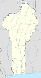
| Tchaourou | |
|---|---|
| Commune and city | |
 | |
| Coordinates: 8°53′N 2°36′E / 8.883°N 2.600°E / 8.883; 2.600 | |
| Country | |
| Department | Borgou Department |
| Area | |
| • Total | 2,802 sq mi (7,256 km) |
| Population | |
| • Total | 221,108 |
| Time zone | UTC+1 (WAT) |
Tchaourou [tʃa.u.ʁu] (Saworo in Yoruba etymology, meaning rattle) is a commune, arrondissement, and city located in the Borgou Department of Benin, a country in Western Africa, formerly known as Dahomey (until 1975). It is the birthplace of former Beninese president Yayi Boni. It is 50 kilometres (31 mi) south of Parakou.
Overview
Tchaourou is a city and commune located in the Borgou Department in northern Benin, West Africa. It is situated about 50 kilometers south of the city of Parakou. The commune covers an area of 7,256 square kilometers, making it the largest in Benin. Tchaourou has a population of over 221,000 people as of the 2013 census, with the city itself home to approximately 106,852 residents.
The region is culturally diverse, with a population speaking multiple languages, including Bariba, Fula (Fulfulde), Yoruba, Otamari, and Yom Lokpa. It is notably the birthplace of former President Yayi Boni, which has contributed to its prominence in national politics.
Economically, Tchaourou is primarily based on agriculture, with fertile lands supporting the cultivation of crops such as cotton, maize, and millet. Livestock farming also plays a role in the local economy. The commune has been focusing on infrastructure development, particularly in areas like transportation, education, and healthcare, to improve the quality of life for its residents.
Tchaourou experiences a tropical savanna climate, with distinct wet and dry seasons that significantly influence the agricultural activities in the area.
Climate
| Climate data for Tchaourou | |||||||||||||
|---|---|---|---|---|---|---|---|---|---|---|---|---|---|
| Month | Jan | Feb | Mar | Apr | May | Jun | Jul | Aug | Sep | Oct | Nov | Dec | Year |
| Mean daily maximum °C (°F) | 34 (94) |
36 (96) |
36 (96) |
34 (94) |
33 (91) |
31 (88) |
28 (83) |
27 (81) |
29 (85) |
31 (87) |
33 (91) |
34 (93) |
32 (90) |
| Mean daily minimum °C (°F) | 19 (67) |
22 (71) |
23 (73) |
23 (73) |
22 (72) |
22 (71) |
21 (70) |
21 (69) |
21 (70) |
21 (69) |
21 (69) |
18 (64) |
21 (70) |
| Average precipitation mm (inches) | 7.6 (0.3) |
15 (0.6) |
58 (2.3) |
100 (4.1) |
140 (5.6) |
160 (6.3) |
170 (6.5) |
160 (6.4) |
210 (8.4) |
160 (6.3) |
15 (0.6) |
7.6 (0.3) |
1,210 (47.7) |
| Source: Weatherbase | |||||||||||||
Demographics

The main languages of Tchaourou are Bariba, Fula (Fula: Fulfulde; French: Peul), Yoruba, Otamari and Yom Lokpa.
Administration
The commune is divided administratively into 7 arrondissements, in 5 quarters and 31 villages.
| Arrondissements | Quartiers & villages |
|---|---|
| Tchaourou | Tchalla, Oke Lagba |
| Alafiarou | |
| Bétérou | |
| Goro | |
| Kika | |
| Sanson | |
| Tchatchou |
References
- "Benin president safe after gunmen ambush". Xinhua. People's Daily Online. 17 March 2007. Retrieved 2009-01-11.
- "Weatherbase: Historical Weather for Tchaourou, Benin". Weatherbase. 2011. Retrieved on November 24, 2011.
8°53′N 2°36′E / 8.883°N 2.600°E / 8.883; 2.600
| Yoruba topics | |||||||||
|---|---|---|---|---|---|---|---|---|---|
| History | |||||||||
| Subgroups | |||||||||
| Yoruboid languages | |||||||||
| Politics | |||||||||
| Geography (Yorubaland) |
| ||||||||
| Demographics | |||||||||
| Culture | |||||||||
| Education & philosophy | |||||||||
| Yoruba Misplaced Pages | |||||||||
5. The World Bank. "Benin - Rural Development." World Bank - Rural Development
6. Cissé, A. (2014). Yayi Boni: A Political Biography. Presses Universitaires d'Afrique.
Categories: