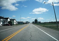
Municipality in Quebec, Canada
| Taschereau | |
|---|---|
| Municipality | |
 | |
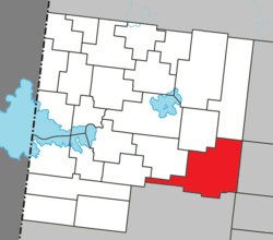
 Location within Abitibi-Ouest RCM Location within Abitibi-Ouest RCM | |
 | |
| Coordinates: 48°40′N 78°41′W / 48.667°N 78.683°W / 48.667; -78.683 | |
| Country | Canada |
| Province | Quebec |
| Region | Abitibi-Témiscamingue |
| RCM | Abitibi-Ouest |
| Settled | 1911 |
| Constituted | December 27, 2001 |
| Government | |
| • Mayor | Michael Otis |
| • Federal riding | Abitibi—Témiscamingue |
| • Prov. riding | Abitibi-Ouest |
| Area | |
| • Total | 272.50 km (105.21 sq mi) |
| • Land | 246.96 km (95.35 sq mi) |
| Population | |
| • Total | 898 |
| • Density | 3.6/km (9/sq mi) |
| • Pop (2016-21) | |
| • Dwellings | 460 |
| Time zone | UTC−5 (EST) |
| • Summer (DST) | UTC−4 (EDT) |
| Postal code(s) | J0Z 3N0 |
| Area code | 819 |
| Highways | |
| Website | taschereau |
Taschereau (French pronunciation: [taʃʁo]) is a municipality in northwestern Quebec, Canada in the Abitibi-Ouest Regional County Municipality. It covers 246.97 km and had a population of 898 as of the Canada 2021 Census.
The municipality was incorporated on December 27, 2001, when the Village Municipality of Taschereau and the Municipality of Taschereau were amalgamated. It is named after Louis-Alexandre Taschereau.
Demographics
|
| |||||||||||||||||||||||||||||||||||||||||||||||||||||||||
| Between 2001 and 2006, The village of Taschereau was merged with the municipality of Taschereau Source: Statistics Canada | ||||||||||||||||||||||||||||||||||||||||||||||||||||||||||
Private dwellings occupied by usual residents (2021): 425 (total dwellings: 460)
Mother tongue (2021):
- English as first language: 0.6%
- French as first language: 98.9%
- English and French as first language: 0%
- Other as first language: 0.6%
Government
Municipal council (as of 2023):
- Mayor: Michael Otis
- Councillors: Mathieu Cloutier, Zacharie Cloutier-Julien, Henri Lampron, Julien Chalifoux, Patrick Landry, Sylvain Cameron
List of former mayors (since formation of current municipality):
- Jean-Marie Poulin (2001–2009)
- Lucien Côté (2009–2013, 2017–2021)
- Manon Luneau (2013–2017)
- Michaël Otis (2021–present)
References
- ^ "Banque de noms de lieux du Québec: Reference number 61771". toponymie.gouv.qc.ca (in French). Commission de toponymie du Québec.
- ^ "Taschereau". Répertoire des municipalités (in French). Ministère des Affaires municipales et de l'Habitation. Retrieved 2023-07-12.
- ^ "Taschereau census profile". 2021 Census data. Statistics Canada. 9 February 2022. Retrieved 2022-04-19.
External links
 Media related to Taschereau, Quebec at Wikimedia Commons
- Official website
| Adjacent Municipal Subdivisions | ||||||||||||||||
|---|---|---|---|---|---|---|---|---|---|---|---|---|---|---|---|---|
| ||||||||||||||||
| Towns | |
|---|---|
| Municipalities | |
| Townships | |
| Parishes | |
| Unorganized territories | |
| |
This Abitibi-Témiscamingue location article is a stub. You can help Misplaced Pages by expanding it. |