50°33′04″N 4°54′00″W / 50.551°N 4.900°W / 50.551; -4.900

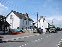
Splatt is a small settlement in north Cornwall, England, at grid reference SW 945 763. It lies in St Minver Lowlands parish between Pityme and Rock, although the buildings along the Rock Road are continuous.
It should not be confused with Splatt in the parish of Tresmeer.
References
- Ordnance Survey Landranger 200; Newquay, Bodmin & surrounding area, 1:50 000. 1988
- Ordnance Survey One-inch Map of England & Wales; Bodmin and Launceston, sheet 186. 1946
External links
![]() Media related to Splatt, Cornwall at Wikimedia Commons
Media related to Splatt, Cornwall at Wikimedia Commons
| Cornwall Portal | |
| Unitary authorities | |
| Major settlements (cities in italics) |
|
| Rivers | |
| Topics | |
This article about a location in the former district of North Cornwall, England is a stub. You can help Misplaced Pages by expanding it. |