Place in Khojaly, Azerbaijan
| Shosh / Shushikend Շոշ / Şuşikənd | |
|---|---|
 | |
  | |
| Coordinates: 39°46′12″N 46°47′05″E / 39.77000°N 46.78472°E / 39.77000; 46.78472 | |
| Country | |
| • District | Khojaly |
| Elevation | 1,024 m (3,360 ft) |
| Population | |
| • Total | 641 |
| Time zone | UTC+4 (AZT) |
Shosh (Armenian: Շոշ) or Shushikend (Armenian: Շուշիքենդ; Azerbaijani: Şuşikənd, Russian: Шушике́нд) is a village in the Khojaly District of Azerbaijan, in the region of Nagorno-Karabakh. Until 2023 it was controlled by the breakaway Republic of Artsakh. The village had an ethnic Armenian-majority population until the exodus of the Armenian population of Nagorno-Karabakh following the 2023 Azerbaijani offensive in Nagorno-Karabakh.
History
Shosh's name and history is connected to that of Shusha (Shushi), which is located a short distance from the village. The Armenian historian Leo considered it likely that the village Shosh received its name from Shushi, which he considered the older settlement, although some sources say that Shushi received its name from the village.
During the Soviet period, the village was part of the Askeran District of the Nagorno-Karabakh Autonomous Oblast. The village has been administered by the Republic of Artsakh since the First Nagorno-Karabakh War.
After the 2020 Nagorno-Karabakh war, five Armenian families displaced from Vazgenashen (Gulably) settled in the village, as well as in Ivanyan (Khojaly).
Historical heritage sites
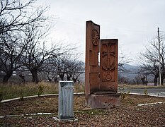
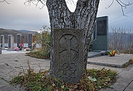
There are three Armenian churches in the village, the 19th-century church of Surb Astvatsatsin (Armenian: Սուրբ Աստվածածին, lit. 'Holy Mother of God') in the village centre, St. Stephen's Church (Armenian: Սուրբ Ստեփանոս եկեղեցի, romanized: Surb Stepanos Yekeghetsi) built in 1655 on the village cemetery grounds, and above the village on a hill in the north, there is a church with an adjacent cemetery with khachkars. The 19th-century chapel of Karmir Taran (Armenian: Կարմիր Տարան) is also located in the village. Other historical heritage sites in and around the village include the medieval shrine of Shoghasar (Armenian: Շողասար), a 17th-century khachkar, the 18th-century bridge of Dzakhlik (Armenian: Ձախլիկ), and a 19th-century watermill. A monument in honor of the 18th-century Armenian satirist and fabulist Pele Pughi was built in 1976 between Shosh and Mkhitarashen.
Economy and culture
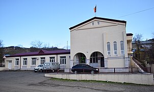
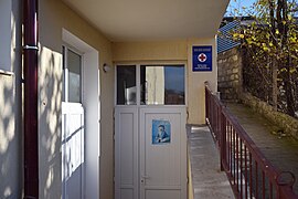
The population is mainly engaged in agriculture and animal husbandry. As of 2015, the village has a municipal building, a house of culture, a secondary school, four shops, and a medical centre.
Demographics
The village had 544 inhabitants in 2005, and 641 inhabitants in 2015.
Notable people
- Arsen Terteryan (1882-1953) – Soviet Armenian scientist and writer
- Pele Pughi (1731-1810) – Armenian satirist and fabulist
Gallery
-
 A view of the village
-
 WWII memorial
-
 Khachkar
-
 Sign reading "Shosh" in Armenian and Latin characters
-
 Cemetery
-
 Village church
-
 Church door
-
 World War II memorial wall
-
 Municipal building
-
 School
-
 Medical center
-
 A view of the village
References
- ^ Hakob Ghahramanyan. "Directory of socio-economic characteristics of NKR administrative-territorial units (2015)".
- Андрей Зубов. "Андрей Зубов. Карабах: Мир и Война". drugoivzgliad.com.
- Sauer, Pjotr (2 October 2023). "'It's a ghost town': UN arrives in Nagorno-Karabakh to find ethnic Armenians have fled". The Guardian. ISSN 0261-3077. Retrieved 9 November 2023.
- "Brockhaus and Efron Encyclopedic Dictionary". Archived from the original on 7 April 2019. Retrieved 7 September 2021.
- Mkrtchyan, Shahen (1980). "City of Shushi (Շուշի քաղաքը)". Լեռնային Ղարաբաղի պատմա-ճարտարապետական հուշարձանները [Historical-architectural monuments of Mountainous Karabakh] (PDF) (in Armenian). Yerevan: Hayastan publishing house. p. 146. Archived (PDF) from the original on 14 July 2021. Retrieved 16 December 2020.
- Մարտունու շրջանի Վազգենաշեն համայնքը նույնպես անցել է Ադրբեջանին
- Մարտունու շրջանի Վազգենաշեն համայնքը նույնպես անցել է Ադրբեջանի վերահսկողության ներքո
- Mkrtchyan, Shahen. Historical-Architectural Monuments of Nagorno Karabagh. Yerevan, 1989. (Շահեն Մկրտչյան, «Լեռնային Ղարաբաղի պատմաճարտարապետական հուշարձանները»)
- Kiesling, Brady; Kojian, Raffi (2019). Rediscovering Armenia: An in-depth inventory of villages and monuments in Armenia and Artsakh (3rd ed.). Armeniapedia Publishing.
- "Pele Pughi Monument - Symbol of Humor and Joy of Artsakh People". armedia.am. 2020-06-06.
- "The Results of the 2005 Census of the Nagorno-Karabakh Republic" (PDF). National Statistic Service of the Republic of Artsakh.
External links
| Askeran Province | ||
|---|---|---|
| Capital: Askeran | ||
| Urban communities |  | |
| Rural communities |
| |
| Not under Artsakh control | ||
