Human settlement in England
| Shawforth | |
|---|---|
 Market Street Market Street | |
  | |
| Population | 3,586 (2011. Ward of Facit and Shawforth) |
| OS grid reference | SD892207 |
| • London | 173 mi (278 km) SSE |
| Civil parish | |
| District | |
| Shire county | |
| Region | |
| Country | England |
| Sovereign state | United Kingdom |
| Post town | ROCHDALE |
| Postcode district | OL12 |
| Dialling code | 01706 |
| Police | Lancashire |
| Fire | Lancashire |
| Ambulance | North West |
| UK Parliament | |
| |
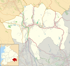
Shawforth (/ˈʃɔːfərθ/ SHAW-fərth) is a ward in the township of Whitworth within the Rossendale borough of Lancashire, England. It lies amongst the South Pennines along the course of the River Spodden and A671 road.
Shawforth in the Middle Ages was a hamlet within the township of Spotland and parish of Rochdale.
Shawforth railway station served Shawforth from 1881 until its closure in 1947.
It is part of the Rossendale and Darwen constituency, with Jake Berry having been the Member of Parliament since 2010.
References
- Notes
- Clarke 1830, p. 156.
- Bibliography
- Clarke, Stephen Reynolds (1830). The New Lancashire Gazetteer: Or, Topographical Dictionary, Containing an Accurate Description of the Several Hundreds, Boroughs, Market Towns, Parishes, Townships, and Hamlets, in the County Palatine of Lancaster. H. Teesdale and Co.
External links
![]() Media related to Shawforth at Wikimedia Commons
Media related to Shawforth at Wikimedia Commons
| Geography of the Borough of Rossendale | |||||||||
|---|---|---|---|---|---|---|---|---|---|
| Towns | |||||||||
| Villages | |||||||||
| Hamlets | |||||||||
| Parishes | |||||||||
| Topography |
| ||||||||
This Lancashire location article is a stub. You can help Misplaced Pages by expanding it. |