| This article relies largely or entirely on a single source. Relevant discussion may be found on the talk page. Please help improve this article by introducing citations to additional sources. Find sources: "Sarahandrano" – news · newspapers · books · scholar · JSTOR (May 2015) |
| Sarahandrano | |
|---|---|
 | |
| Coordinates: 14°47′S 50°1′E / 14.783°S 50.017°E / -14.783; 50.017 | |
| Country | |
| Region | Sava |
| District | Antalaha |
| Population | |
| • Total | 12,758 |
| Time zone | UTC3 (EAT) |
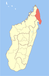
Sarahandrano is a commune (Malagasy: kaominina) in northern Madagascar. It belongs to the district of Antalaha, which is a part of Sava Region. According to 2001 census the population of Sarahandrano was 12,758.
Primary and junior level secondary education are available in town. The majority 99% of the population are farmers. The most important crops are rice and vanilla; also coffee is an important agricultural product. Services provide employment for 1% of the population.
Notes
- ^ "ILO census data". Cornell University. 2002. Retrieved 2008-02-15.
| Capital: Sambava | ||
| Andapa (17) |  | |
| Antalaha (14) | ||
| Sambava (25) | ||
| Vohemar (19) | ||
| 4 districts; 75 communes | ||
14°47′S 50°1′E / 14.783°S 50.017°E / -14.783; 50.017
This Sava region of Madagascar location article is a stub. You can help Misplaced Pages by expanding it. |