| The topic of this article may not meet Misplaced Pages's notability guideline for geographic features. Please help to demonstrate the notability of the topic by citing reliable secondary sources that are independent of the topic and provide significant coverage of it beyond a mere trivial mention. If notability cannot be shown, the article is likely to be merged, redirected, or deleted. Find sources: "Rountree, Springfield" – news · newspapers · books · scholar · JSTOR (February 2019) (Learn how and when to remove this message) |

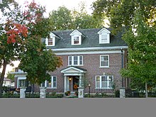
Rountree is a neighborhood in central Springfield, Missouri. The neighborhood's borders are marked by Missouri State University to the west, Glenstone Avenue to the east, Catalpa Street to the south, and Cherry Street to the north. Rountree is predominantly residential, but is home to several popular restaurants, bakeries, and other businesses. The majority of homes in Rountree were constructed during the 1910s and 1920s. Architecture in the neighborhood is diverse, with many examples of Craftsman, Foursquare, and Federalist styles.
Rountree, like other neighborhoods in central Springfield, is markedly more liberal in its voting patterns than other parts of the city. This may be due to its close proximity to the Missouri State University campus.
The neighborhood's name derives from the N.M. Rountree Elementary School, located within the neighborhood on Grand Street. The school, in turn, is named the founder of the historic Keet-Rountree store in Springfield. The neighborhood hosts annual Fourth of July and Halloween parades that draw hundreds from around the city. Rountree is regularly ranked by 417 Magazine as among Springfield's best neighborhoods.
References
- https://www.springfieldmo.gov/DocumentCenter/View/4787
- "Four maps that explain how Greene County voted". news-leader.com.
- "Celebrating Rountree's first 100 years - Ozarks Alive". ozarksalive.com. March 31, 2017.
- "417 Magazine's Best of 417 Reader's Choice Award Winners". www.417mag.com. February 2018.
37°12′04″N 93°16′12″W / 37.201°N 93.270°W / 37.201; -93.270
This Greene County, Missouri state location article is a stub. You can help Misplaced Pages by expanding it. |