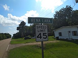
Census-designated place in Mississippi, United States
| Rena Lara, Mississippi | |
|---|---|
| Census-designated place | |
 | |
  | |
| Coordinates: 34°08′59″N 90°46′49″W / 34.14972°N 90.78028°W / 34.14972; -90.78028 | |
| Country | United States |
| State | Mississippi |
| County | Coahoma |
| Area | |
| • Total | 2.29 sq mi (5.94 km) |
| • Land | 2.29 sq mi (5.94 km) |
| • Water | 0.00 sq mi (0.00 km) |
| Elevation | 154 ft (47 m) |
| Population | |
| • Total | 123 |
| • Density | 53.66/sq mi (20.72/km) |
| Time zone | UTC-6 (Central (CST)) |
| • Summer (DST) | UTC-5 (CDT) |
| Area code | 662 |
| GNIS feature ID | 2812719 |
Rena Lara is a census-designated place and unincorporated community located along Mississippi Highway 1 in southwestern Coahoma County, Mississippi, United States. Rena Lara is located on the former Riverside Division of the Yazoo and Mississippi Valley Railroad. Rena Lara was once home to two general stores, two grocery stores, and the Richardson and May Land & Planting Company.
it has a post office, with the ZIP code 38767. The post office first began operation in 1895.
Pepper Sharpe, a Negro league pitcher, was born in Rena Lara.
It was first named as a CDP in the 2020 Census which listed a population of 123.
Demographics
| Census | Pop. | Note | %± |
|---|---|---|---|
| 2020 | 123 | — | |
| U.S. Decennial Census 2020 | |||
2020 census
| Race / Ethnicity (NH = Non-Hispanic) | Pop 2020 | % 2020 |
|---|---|---|
| White alone (NH) | 102 | 82.93% |
| Black or African American alone (NH) | 13 | 10.57% |
| Native American or Alaska Native alone (NH) | 0 | 0.00% |
| Asian alone (NH) | 0 | 0.00% |
| Pacific Islander alone (NH) | 0 | 0.00% |
| Some Other Race alone (NH) | 0 | 0.00% |
| Mixed Race or Multi-Racial (NH) | 7 | 5.69% |
| Hispanic or Latino (any race) | 1 | 0.81% |
| Total | 123 | 100.00% |
References
- "2020 U.S. Gazetteer Files". United States Census Bureau. Retrieved July 24, 2022.
- ^ U.S. Geological Survey Geographic Names Information System: Rena Lara, Mississippi
- Rowland, Dunbar (1907). Mississippi: Comprising Sketches of Counties, Towns, Events, Institutions, and Persons, Arranged in Cyclopedic Form. Vol. 2. Southern Historical Publishing Association. p. 537.
- Howe, Tony. "Rena Lara, Mississippi". Mississippi Rails. Retrieved June 10, 2020.
- USPS – Cities by ZIP Code
- "Coahoma County". Jim Forte Postal History. Retrieved June 10, 2020.
- "Pepper Sharpe Negro Leagues Statistics & History". baseball-reference.com. Retrieved May 26, 2021.
- "Rena Lara CDP, Mississippi". United States Census Bureau. Retrieved March 13, 2022.
- "Decennial Census of Population and Housing by Decades". US Census Bureau.
- ^ "P2 Hispanic or Latino, and Not Hispanic or Latino by Race – 2020: DEC Redistricting Data (PL 94-171) - Rena Lara CDP, Mississippi". United States Census Bureau.
| Municipalities and communities of Coahoma County, Mississippi, United States | ||
|---|---|---|
| County seat: Clarksdale | ||
| City |  | |
| Towns | ||
| CDPs | ||
| Other communities | ||
| Ghost towns | ||
| Footnotes | ‡This populated place also has portions in an adjacent county or counties | |
This Coahoma County, Mississippi state location article is a stub. You can help Misplaced Pages by expanding it. |