   | |
| Geography | |
|---|---|
| Location | Caribbean |
| Coordinates | 17°10′34″N 61°47′52″W / 17.17611°N 61.79778°W / 17.17611; -61.79778 |
| Administration | |
| Additional information | |
| Time zone | |

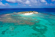
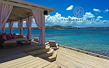
Prickly Pear Island is an islet approx. 650 metres off the north shore coast of Hodges Bay on the much larger island of Antigua, West Indies. The island measures approx. 50 metres north to south, and approx. 50 metres east to west. The small uninhabited island is home to the Prickly Pear Beach Club at Hodges Bay, a favorite day-time escape for the celebrity elite.
References
- "Country Guide: Antigua". MarieClaire.co.uk. 13 November 2007. Retrieved 21 January 2010.
- "Antigua Guide". Archived from the original on 2011-12-11. Retrieved 2010-03-02.
- "Commercial site offering trips to Prickly Pear Island".
- Marikar, Sheila Yasmin (2022-03-10). "The Mother-Daughter Vacation Must Go On". The Cut. Retrieved 2022-04-04.

This Antigua and Barbuda location article is a stub. You can help Misplaced Pages by expanding it. |