| Pip Ivan | |
|---|---|
 | |
| Highest point | |
| Elevation | 1,938 m (6,358 ft) |
| Coordinates | 48°05′30″N 24°35′45″E / 48.09167°N 24.59583°E / 48.09167; 24.59583 |
| Geography | |
  | |
| Parent range | Carpathian Mountains |

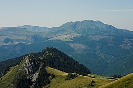
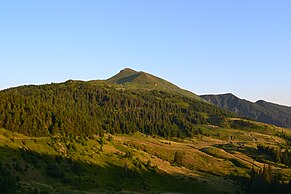
Pip Ivan (Ukrainian: Піп Іван, Romanian: Pop Ivan) is a peak in the Maramureș region on the Ukrainian-Romanian border, with a height of 1,938 meters (6,358 ft) above sea level.
References
- Travaux du Muséum d'histoire naturelle "Grigore Antipa." 1996. The Maramureș Mountains are extended from the Bistrița Valley to the frontier, on the right bank of the Vișeu river, and consist of a broad, fragmented summit, oriented South-East, North-West. From the geological viewpoint the territory is very varied, with crystalline schists at summit Pop-Ivan (1,937 m (6,355 ft)) pierced by eruptive rocks (Toroioaga, 1,930 m (6,330 ft)) or Mesozoic basalts from the zone of Farcău (1,957 m (6,421 ft)) and Mihăileț (1,918 m (6,293 ft)). There are Cretacic sediments, gritstone, limestones, conglomerates, ...
- Географічна енциклопедія України: в 3-х томах / Редколегія: О. М. Маринич (відпов. ред.) та ін. — К.: «Українська радянська енциклопедія» імені М. П. Бажана, 1989.
- Highest peaks of Carpathians
This article about a location in Ivano-Frankivsk Oblast is a stub. You can help Misplaced Pages by expanding it. |