| Osterhusen | |
|---|---|
| Village of Hinte | |
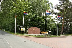
 Monument for the Accord of Osterhusen Monument for the Accord of Osterhusen | |
 Coat of arms Coat of arms | |
| Location of Osterhusen | |
  | |
| Coordinates: 53°25′09″N 7°12′17″E / 53.41904°N 7.20477°E / 53.41904; 7.20477 | |
| Country | Germany |
| State | Lower Saxony |
| District | Aurich |
| Municipality | Hinte |
| Elevation | 3 m (10 ft) |
| Population | |
| • Metro | 500 |
| Time zone | UTC+01:00 (CET) |
| • Summer (DST) | UTC+02:00 (CEST) |
| Postal codes | 26759 |
| Dialling codes | 04925 |
Osterhusen is a village in the region of East Frisia, in Lower Saxony, Germany. Administratively, it is an Ortsteil of the municipality of Hinte, of which it is located to the northeast. Westerhusen is to the west of Suurhusen and Loppersum.
The village dates back to the 10th century as Ostahusun. In 1611, the Accord of Osterhusen was concluded here in which Count Enno III of East Frisia made peace with his rebellious subjects under pressure from the States-General of the Dutch Republic.
Notable people
- Adolph Occo (1447–1503), physician and humanist
References
- Pries, Axel (30 April 2021). "Osterhusen ist mehr als ein Vorort von Hinte" [Osterhusen is more than just a suburb of Hinte]. NWZ Online (in German). Retrieved 19 March 2024.
- "Der "Osterhusische Akkord" von 1611" [The “Osterhusian Accord” from 1611]. Die Holtgaster Heimat-Geschichte (in German). Retrieved 19 March 2024.
| Villages in the municipality of Hinte | ||
|---|---|---|
This German location article is a stub. You can help Misplaced Pages by expanding it. |