| This article needs additional citations for verification. Please help improve this article by adding citations to reliable sources. Unsourced material may be challenged and removed. Find sources: "Odengatan" – news · newspapers · books · scholar · JSTOR (February 2024) (Learn how and when to remove this message) |
59°20′48.2″N 18°3′59″E / 59.346722°N 18.06639°E / 59.346722; 18.06639


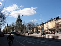
Odengatan is a major street in the districts Vasastan and Östermalm in central Stockholm.
It is connected to Vallhallavägen, from where it passes Stockholm Public Library, Odenplan, Gustaf Vasa Church and Vasaparken up to S:t Eriksplan. The street's width is about 30 metres and its length is about 1850 metres.
Buildings at Odengatan
See also
References
- Adams, Nicholas (2015-01-14). Gunnar Asplund's Gothenburg: The Transformation of Public Architecture in Interwar Europe. Penn State Press. ISBN 978-0-271-06520-5.
This Stockholm road or road transport-related article is a stub. You can help Misplaced Pages by expanding it. |