Village in Illinois, United States
| Oakwood Village of Oakwood | |
|---|---|
| Village | |
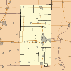
 Location of Oakwood in Vermilion County, Illinois. Location of Oakwood in Vermilion County, Illinois. | |
 | |
| Coordinates: 40°6′36″N 87°46′37″W / 40.11000°N 87.77694°W / 40.11000; -87.77694 | |
| Country | United States |
| State | Illinois |
| County | Vermilion |
| Township | Oakwood |
| Area | |
| • Total | 0.93 sq mi (2.40 km) |
| • Land | 0.93 sq mi (2.40 km) |
| • Water | 0.00 sq mi (0.00 km) 0% |
| Elevation | 640 ft (200 m) |
| Population | |
| • Total | 1,325 |
| • Density | 1,427.80/sq mi (551.11/km) |
| Time zone | UTC-6 (CST) |
| • Summer (DST) | UTC-5 (CDT) |
| ZIP code | 61858 |
| Area code | 217 |
| FIPS code | 17-55002 |
| GNIS ID | 2399547 |
| Website | oakwoodil |
Oakwood is a village in Oakwood Township, Vermilion County, Illinois, United States. It is part of the Danville, Illinois Metropolitan Statistical Area. The population was 1,595 at the 2010 census, and 1,507 in 2018.
Geography

According to the 2010 census, Oakwood has a total area of 0.93 square miles (2.41 km), all land.
History
The area where Oakwood currently is built was historically inhabited by the Kickapoo and Potawatomi, both tribes of indigenous peoples. The Potawatomi camp was located on the south side of Oakwood, near the modern-day Lake Bluff trailer park. The indigenous peoples discovered the salts mines which would later become the start of the town’s economy. In the early 1800s, fur trappers arrived in the area and drove the Kickapoo peoples into Missouri.
On October 31, 1819 an army surveyor team arrived in the region. The team was composed of Captain Blackman, George Beckwith, Seymour Treat, Peter Allen, and Francis Whitcomb, and set up camp on the north side of Salt Fork Vermilion River on the modern-day southeast corner of Oakwood, where they set up a salt mine boiling off salty water from the ground. In 1824, John W. Vance would gain control of the mine and increase production; due to competition from other mines the mine eventually shut down and people moved out.
From the 1850s to the 1940s coal mining became a major source of jobs and industry in Vermilion County.
Demographics
| Census | Pop. | Note | %± |
|---|---|---|---|
| 1880 | 99 | — | |
| 1910 | 423 | — | |
| 1920 | 573 | 35.5% | |
| 1930 | 537 | −6.3% | |
| 1940 | 555 | 3.4% | |
| 1950 | 641 | 15.5% | |
| 1960 | 861 | 34.3% | |
| 1970 | 1,367 | 58.8% | |
| 1980 | 1,627 | 19.0% | |
| 1990 | 1,533 | −5.8% | |
| 2000 | 1,502 | −2.0% | |
| 2010 | 1,595 | 6.2% | |
| 2020 | 1,325 | −16.9% | |
| U.S. Decennial Census | |||
As of the census of 2000, there were 1,502 people, 621 households, and 435 families residing in the village. The population density was 1,669.8 inhabitants per square mile (644.7/km). There were 639 housing units at an average density of 710.4 per square mile (274.3/km). The racial makeup of the village was 99.33% White, 0.13% African American, 0.20% Native American, 0.07% Asian, and 0.27% from two or more races. Hispanic or Latino of any race were 0.53% of the population.
There were 621 households, out of which 34.3% had children under the age of 18 living with them, 52.3% were married couples living together, 14.0% had a female householder with no husband present, and 29.8% were non-families. 25.6% of all households were made up of individuals, and 13.5% had someone living alone who was 65 years of age or older. The average household size was 2.42 and the average family size was 2.87.
In the village, the population was spread out, with 26.5% under the age of 18, 8.3% from 18 to 24, 27.4% from 25 to 44, 24.8% from 45 to 64, and 13.0% who were 65 years of age or older. The median age was 36 years. For every 100 females, there were 92.1 males. For every 100 females age 18 and over, there were 82.5 males.
The median income for a household in the village was $41,477, and the median income for a family was $44,583. Males had a median income of $31,107 versus $23,320 for females. The per capita income for the village was $18,655. About 7.8% of families and 8.1% of the population were below the poverty line, including 11.5% of those under age 18 and 10.1% of those age 65 or over.
Notable people
- Margaret W. Campbell was buried in the family plot in an Oakwood Cemetery
- Darrin Fletcher, catcher for several Major League Baseball teams.
- Bobby Pierce, racing driver on several national tours
- Angela Watson, actress (Step by Step)
- Cameron Lee, offensive lineman for several National Football League teams

Schools
- Oakwood Grade School
- Mascot: "Stars"
- Oakwood Junior High School
- Mascot: "Knights"
- Oakwood High School
- Mascot:"Comets"
- Song: "Cheer, Cheer, for old Oakwood's fame. Wake up the echoes cheering her name. Send the volley cheer on high. Shake down the thunder from the sky. What though the odds be great or small, old Oakwood High will win overall, while her loyal sons are marching onward to victory. Repeat."
References
- "2020 U.S. Gazetteer Files". United States Census Bureau. Retrieved March 15, 2022.
- ^ U.S. Geological Survey Geographic Names Information System: Oakwood, Illinois
- "G001 - Geographic Identifiers - 2010 Census Summary File 1". United States Census Bureau. Archived from the original on February 13, 2020. Retrieved December 25, 2015.
- "History". Village of Oakwood. Retrieved March 9, 2022.
- ^ "Oakwood History". My roots run deep. Retrieved March 9, 2022.
- "Census of Population and Housing". Census.gov. Retrieved June 4, 2015.
- "U.S. Census website". United States Census Bureau. Retrieved January 31, 2008.
- "Club Events". The Des Moines Register. Des Moines, Iowa. November 13, 1908. p. 5. Retrieved February 9, 2020 – via Newspapers.com.

- Richey, Scott (March 28, 2015). "Sunday Conversation: Darrin Fletcher". The News-Gazette. Retrieved October 3, 2021.
| Municipalities and communities of Vermilion County, Illinois, United States | ||
|---|---|---|
| County seat: Danville | ||
| Cities | ||
| Villages | ||
| Townships | ||
| CDPs | ||
| Other communities | ||
| Footnotes | ‡This populated place also has portions in an adjacent county or counties | |
