Name on the Register
Image
Date listed
Location
City or town
Description
1
Bates-Sheppard House
Bates-Sheppard House October 31, 1988(#88001948 )
312 E. Broadway29°05′33″N 97°17′11″W / 29.0925°N 97.286389°W / 29.0925; -97.286389 (Bates-Sheppard House) Cuero Recorded Texas Historic Landmark
2
John Y. Bell House
John Y. Bell House October 31, 1988(#88001982 )
304 E. Prairie29°05′46″N 97°17′07″W / 29.096111°N 97.285278°W / 29.096111; -97.285278 (John Y. Bell House) Cuero
3
M. D. Bennett House
M. D. Bennett House October 31, 1988(#88001963 )
208 N. Hunt29°05′24″N 97°17′12″W / 29.09°N 97.286667°W / 29.09; -97.286667 (M. D. Bennett House) Cuero
4
Billow-Thompson House
Billow-Thompson House October 31, 1988(#88001949 )
402 E. Broadway29°05′32″N 97°17′09″W / 29.092222°N 97.285833°W / 29.092222; -97.285833 (Billow-Thompson House) Cuero
5
Breeden-Runge Wholesale Grocery Company Building
Breeden-Runge Wholesale Grocery Company Building October 31, 1988(#88001957 )
108 N. Frederick William29°05′32″N 97°17′43″W / 29.092222°N 97.295278°W / 29.092222; -97.295278 (Breeden-Runge Wholesale Grocery Company Building) Cuero
6
Floyd Buchel House
Floyd Buchel House October 31, 1988(#88001950 )
407 E. Broadway29°05′29″N 97°17′09″W / 29.091389°N 97.285833°W / 29.091389; -97.285833 (Floyd Buchel House) Cuero
7
Arthur Burns House
Arthur Burns House October 31, 1988(#88001987 )
130 E. Sarah29°05′44″N 97°17′14″W / 29.095556°N 97.287222°W / 29.095556; -97.287222 (Arthur Burns House) Cuero
8
John W. Burns House
John W. Burns House October 31, 1988(#88001947 )
311 E. Broadway29°05′31″N 97°17′13″W / 29.091944°N 97.286944°W / 29.091944; -97.286944 (John W. Burns House) Cuero
9
Callaway-Gillette House
Callaway-Gillette House October 31, 1988(#88001989 )
306 E. Sarah29°05′42″N 97°17′07″W / 29.095°N 97.285278°W / 29.095; -97.285278 (Callaway-Gillette House) Cuero
10
J. B. Chaddock House
J. B. Chaddock House October 31, 1988(#88001995 )
202 S. Valley29°05′10″N 97°17′06″W / 29.086111°N 97.285°W / 29.086111; -97.285 (J. B. Chaddock House) Cuero
11
City Water Works
City Water Works More images
October 31, 1988(#88001956 )
208 S. Esplanade29°05′21″N 97°17′33″W / 29.089167°N 97.2925°W / 29.089167; -97.2925 (City Water Works) Cuero
12
Clement-Nagel House
Clement-Nagel House October 31, 1988(#88001974 )
701 E. Morgan29°05′07″N 97°17′10″W / 29.085278°N 97.286111°W / 29.085278; -97.286111 (Clement-Nagel House) Cuero
13
Colston-Gohmert House
Colston-Gohmert House October 31, 1988(#88001983 )
309 E. Prairie29°05′44″N 97°17′06″W / 29.095556°N 97.285°W / 29.095556; -97.285 (Colston-Gohmert House) Cuero
14
Charles Cook House
Upload image October 31, 1988(#88001986 )
103 E. Sarah29°05′44″N 97°17′17″W / 29.095556°N 97.288056°W / 29.095556; -97.288056 (Charles Cook House) Cuero Demolished
15
W. H. Crain House
W. H. Crain House October 31, 1988(#88001953 )
508 E. Courthouse29°05′25″N 97°17′08″W / 29.09034°N 97.28544°W / 29.09034; -97.28544 (W. H. Crain House) Cuero
16
Cuero Commercial Historic District
Cuero Commercial Historic District More images
November 17, 1988(#88001996 )
Roughly bounded by Gonzales, Main, Terrell and Courthouse29°05′28″N 97°17′27″W / 29.091111°N 97.290833°W / 29.091111; -97.290833 (Cuero Commercial Historic District) Cuero Includes Recorded Texas Historic Landmark
17
Cuero Gin
Upload image October 31, 1988(#88001970 )
501 W. Main29°05′30″N 97°17′44″W / 29.091667°N 97.295556°W / 29.091667; -97.295556 (Cuero Gin) Cuero Demolished by 2005
18
Cuero High School
Cuero High School October 31, 1988(#88001990 )
405 E. Sarah29°05′55″N 97°17′04″W / 29.098611°N 97.284444°W / 29.098611; -97.284444 (Cuero High School) Cuero
19
Cuero Hydroelectric Plant
Upload image September 19, 1977(#77001514 )
2 mi (3.2 km). N of Cuero on Guadalupe Plant29°07′46″N 97°18′40″W / 29.129444°N 97.311111°W / 29.129444; -97.311111 (Cuero Hydroelectric Plant) Cuero
20
Cuero I Archeological District
Cuero I Archeological District October 9, 1974(#74002271 )
Address restricted Cuero Extends into Gonzales County
21
E. A. Daule House
Upload image October 31, 1988(#88001981 )
201 W. Newman29°05′23″N 97°17′52″W / 29.089722°N 97.297778°W / 29.089722; -97.297778 (E. A. Daule House) Cuero
22
DeWitt County Courthouse
DeWitt County Courthouse More images
May 6, 1971(#71000929 )
Bounded by N. Gonzales, E. Live Oak, N. Clinton, and E. Courthouse Sts.29°05′29″N 97°17′19″W / 29.091389°N 97.288611°W / 29.091389; -97.288611 (DeWitt County Courthouse) Cuero State Antiquities Landmark , Recorded Texas Historic Landmark
23
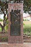
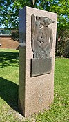
DeWitt County Monument
DeWitt County Monument March 6, 2019(#100003421 )
US 87 & Courthouse St.29°05′17″N 97°16′34″W / 29.088179°N 97.276159°W / 29.088179; -97.276159 (DeWitt County Monument) Cuero
24
East Main Street Residential Historic District
East Main Street Residential Historic District October 31, 1988(#88001998 )
400 to 800 blocks of E. Main St.29°05′16″N 97°17′07″W / 29.087778°N 97.285278°W / 29.087778; -97.285278 (East Main Street Residential Historic District) Cuero
25
Eckhardt Stores
Eckhardt Stores June 29, 1976(#76002020 )
Eckhardt and Main St.28°58′49″N 97°30′13″W / 28.980278°N 97.503611°W / 28.980278; -97.503611 (Eckhardt Stores) Yorktown Recorded Texas Historic Landmark
26
William and L. F. Eichholz House
William and L. F. Eichholz House October 31, 1988(#88001954 )
308 W. Courthouse29°05′37″N 97°17′39″W / 29.093585°N 97.294073°W / 29.093585; -97.294073 (William and L. F. Eichholz House) Cuero
27
English-German School
English-German School October 31, 1988(#88001978 )
201 E. Newman29°05′09″N 97°17′30″W / 29.085833°N 97.291667°W / 29.085833; -97.291667 (English-German School) Cuero Recorded Texas Historic Landmark; building is condemned
28
J. B. Farris House
Upload image October 31, 1988(#88001960 )
502 N. Gonzales29°05′36″N 97°17′18″W / 29.093333°N 97.288333°W / 29.093333; -97.288333 (J. B. Farris House) Cuero Demolished
29
First Methodist Church
First Methodist Church More images
October 31, 1988(#88001952 )
301 E. Courthouse29°05′27″N 97°17′17″W / 29.090833°N 97.288056°W / 29.090833; -97.288056 (First Methodist Church) Cuero
30
Alfred Friar House
Alfred Friar House October 31, 1988(#88001961 )
703 N. Gonzales29°05′42″N 97°17′13″W / 29.095°N 97.286944°W / 29.095; -97.286944 (Alfred Friar House) Cuero
31
William Frobese Sr. House
William Frobese Sr. House October 31, 1988(#88001980 )
305 E. Newman29°05′07″N 97°17′24″W / 29.085278°N 97.29°W / 29.085278; -97.29 (William Frobese Sr. House) Cuero Recorded Texas Historic Landmark
32
Grace Episcopal Church
Grace Episcopal Church October 31, 1988(#88001955 )
401 N. Esplanade29°05′33″N 97°17′23″W / 29.0925°N 97.289722°W / 29.0925; -97.289722 (Grace Episcopal Church) Cuero Recorded Texas Historic Landmark
33
House at 1002 Stockdale
House at 1002 Stockdale October 31, 1988(#88001993 )
1002 Stockdale29°04′47″N 97°17′37″W / 29.079722°N 97.293611°W / 29.079722; -97.293611 (House at 1002 Stockdale) Cuero
34
House at 404 Stockdale
House at 404 Stockdale October 31, 1988(#88001992 )
404 Stockdale29°05′07″N 97°17′27″W / 29.085278°N 97.290833°W / 29.085278; -97.290833 (House at 404 Stockdale) Cuero
35
House at 609 East Live Oak
House at 609 East Live Oak October 31, 1988(#88001968 )
609 E. Live Oak29°05′24″N 97°17′02″W / 29.09°N 97.283889°W / 29.09; -97.283889 (House at 609 East Live Oak) Cuero
36
Keller-Grunder House
Keller-Grunder House October 31, 1988(#88001973 )
409 E. Morgan29°05′11″N 97°17′19″W / 29.086389°N 97.288611°W / 29.086389; -97.288611 (Keller-Grunder House) Cuero Recorded Texas Historic Landmark
37
Albert and Kate Leinhardt House
Albert and Kate Leinhardt House October 31, 1988(#88001976 )
818 E. Morgan29°05′11″N 97°17′01″W / 29.086389°N 97.283611°W / 29.086389; -97.283611 (Albert and Kate Leinhardt House) Cuero
38
Emil Leonardt House
Emil Leonardt House November 4, 1988(#88001975 )
804 E. Morgan29°05′07″N 97°17′05″W / 29.085278°N 97.284722°W / 29.085278; -97.284722 (Emil Leonardt House) Cuero
39
Leske Bar
Upload image October 31, 1988(#88001969 )
432 W. Main29°05′30″N 97°17′41″W / 29.091667°N 97.294722°W / 29.091667; -97.294722 (Leske Bar) Cuero Demolished by 2005, after being damaged in a flood in 1998
40
Valentine Ley House
Valentine Ley House October 31, 1988(#88001979 )
206 E. Newman29°05′10″N 97°17′30″W / 29.086111°N 97.291667°W / 29.086111; -97.291667 (Valentine Ley House) Cuero
41
Lynch-Probst House
Upload image October 31, 1988(#88001951 )
502 E. Broadway29°05′31″N 97°17′06″W / 29.091944°N 97.285°W / 29.091944; -97.285 (Lynch-Probst House) Cuero Demolished
42
Macedonia Baptist Church
Macedonia Baptist Church October 31, 1988(#88001967 )
512 S. Indianola29°05′12″N 97°17′54″W / 29.086667°N 97.298333°W / 29.086667; -97.298333 (Macedonia Baptist Church) Cuero
43
Frank Marie House
Frank Marie House October 31, 1988(#88001959 )
402 E. French29°05′36″N 97°17′07″W / 29.093333°N 97.285278°W / 29.093333; -97.285278 (Frank Marie House) Cuero
44
May-Hickey House
Upload image October 27, 1988(#88002129 )
FM 682 1.7 mi. S of jct. with TX 11129°15′39″N 97°08′40″W / 29.260833°N 97.144444°W / 29.260833; -97.144444 (May-Hickey House) Yoakum Recorded Texas Historic Landmark
45
Meissner-Pleasants House
Meissner-Pleasants House October 31, 1988(#88001962 )
108 N. Hunt29°05′21″N 97°17′12″W / 29.089167°N 97.286667°W / 29.089167; -97.286667 (Meissner-Pleasants House) Cuero
46
Edward Mugge House
Edward Mugge House October 31, 1988(#88001994 )
218 N. Terrell29°05′30″N 97°17′33″W / 29.091667°N 97.2925°W / 29.091667; -97.2925 (Edward Mugge House) Cuero Recorded Texas Historic Landmark
47
Municipal Power Plant
Municipal Power Plant More images
November 15, 1996(#96001356 )
810 Front St.29°17′08″N 97°09′04″W / 29.285556°N 97.151111°W / 29.285556; -97.151111 (Municipal Power Plant) Yoakum Recorded Texas Historic Landmark; now the city library
48
Old Beer and Ice Warehouse
Old Beer and Ice Warehouse October 31, 1988(#88001985 )
104 SW Railroad29°05′23″N 97°17′33″W / 29.089754°N 97.292525°W / 29.089754; -97.292525 (Old Beer and Ice Warehouse) Cuero
49
Charles J. and Alvina Ott House
Charles J. and Alvina Ott House October 31, 1988(#88001965 )
306 N. Hunt29°05′27″N 97°17′10″W / 29.090833°N 97.286111°W / 29.090833; -97.286111 (Charles J. and Alvina Ott House) Cuero
50
S. I. Ott House
S. I. Ott House October 31, 1988(#88001964 )
302 N. Hunt29°05′26″N 97°17′11″W / 29.090556°N 97.286389°W / 29.090556; -97.286389 (S. I. Ott House) Cuero
51
O. F. and Mary Prigden House
O. F. and Mary Prigden House October 31, 1988(#88001958 )
401 E. French29°05′34″N 97°17′08″W / 29.092778°N 97.285556°W / 29.092778; -97.285556 (O. F. and Mary Prigden House) Cuero
52
J. M. Reuss House
J. M. Reuss House October 31, 1988(#88001991 )
315 Stockdale29°05′09″N 97°17′24″W / 29.085833°N 97.29°W / 29.085833; -97.29 (J. M. Reuss House) Cuero
53
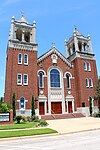
St. Michael's Catholic Church
St. Michael's Catholic Church October 31, 1988(#88001971 )
202 N. McLeod29°05′24″N 97°17′15″W / 29.09°N 97.2875°W / 29.09; -97.2875 (St. Michael's Catholic Church) Cuero
54
State Highway 27 Bridge at the Guadalupe River
State Highway 27 Bridge at the Guadalupe River October 10, 1996(#96001122 )
US 87, .13 mi. S of jct. with US 18329°03′55″N 97°19′20″W / 29.065278°N 97.322222°W / 29.065278; -97.322222 (State Highway 27 Bridge at the Guadalupe River) Cuero
55
Elisha Stevens House
Elisha Stevens House October 31, 1988(#88001984 )
408 E. Prairie29°05′44″N 97°17′02″W / 29.095556°N 97.283889°W / 29.095556; -97.283889 (Elisha Stevens House) Cuero
56
Terrell-Reuss Streets Historic District
Terrell-Reuss Streets Historic District October 31, 1988(#88001997 )
300 to 900 blocks of Terrell, 500 to 900 blocks of Indianola, and 200 blk. of W. Reuss to 400 blk. of E. Reuss29°05′44″N 97°17′18″W / 29.095556°N 97.288333°W / 29.095556; -97.288333 (Terrell-Reuss Streets Historic District) Cuero Includes Recorded Texas Historic Landmarks
57
W. F. Thomson House
W. F. Thomson House October 31, 1988(#88001972 )
608 N. McLeod29°05′37″N 97°17′08″W / 29.093611°N 97.285556°W / 29.093611; -97.285556 (W. F. Thomson House) Cuero
58
Dane Wittenbert House
Dane Wittenbert House October 31, 1988(#88001966 )
402 S. Hunt29°05′05″N 97°17′20″W / 29.084722°N 97.288889°W / 29.084722; -97.288889 (Dane Wittenbert House) Cuero
59
Charles Wittmer House
Charles Wittmer House October 31, 1988(#88001977 )
110 E. Newman29°05′11″N 97°17′33″W / 29.086389°N 97.2925°W / 29.086389; -97.2925 (Charles Wittmer House) Cuero
60
Wofford-Finney House
Wofford-Finney House August 14, 1992(#92000984 )
202 E. Prairie St.29°05′48″N 97°17′11″W / 29.096667°N 97.286389°W / 29.096667; -97.286389 (Wofford-Finney House) Cuero


