 National Highway 15
 | |
|---|---|
| Arabic: الطريق السريع الوطنى 15 French: Route Nationale 15 | |
 | |
 | |
| Route information | |
| Length | 103 km (64 mi) |
| Major junctions | |
| From | Obock |
| To | Eritrean Border |
| Location | |
| Country | Djibouti |
| Major cities | Khôr ‘Angar, Moulhoule |
| Highway system | |
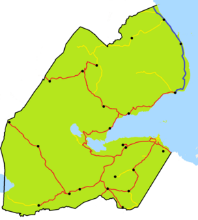
The RN-15 National Highway connects from Obock to Eritrean Border, and is 103 kilometres (64 mi) long, it runs along most of the Bab-el-Mandeb coastline. It is the longest route in Obock Region.
References
- "Traffic and Road Conditions in Djibouti". Country Reports. Retrieved February 3, 2018.
| National Roads of Djibouti | |
|---|---|
| Highways | |
This Djibouti-related article is a stub. You can help Misplaced Pages by expanding it. |
This African road or road transport-related article is a stub. You can help Misplaced Pages by expanding it. |