| Mount Watkin / Hikaroroa | |
|---|---|
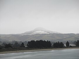
 Fog shrouding the snow covered Mount Watkin / Hikaroroa Fog shrouding the snow covered Mount Watkin / Hikaroroa | |
| Highest point | |
| Elevation | 616 m (2,021 ft) |
| Coordinates | 45°34′S 170°35′E / 45.567°S 170.583°E / -45.567; 170.583 |
| Naming | |
| Etymology | Hikaroroa, after a Kāti-Māmoe warrior Watkin, after Reverend James Watkin |
| Native name | Hiikaroroa (Māori) |
| Geography | |
| Country | New Zealand |
| Region | Otago |
| District | Dunedin |
| Geology | |
| Mountain type | Stratovolcano |
Mount Watkin / Hikaroroa is a 616-metre peak located north-west of Waikouaiti, Otago, New Zealand. It is on the east side of the North Branch of the Waikouaiti River.
The peak was originally named Hikaroroa, after a Kāti-Māmoe warrior, and was renamed after a pioneer Methodist missionary, Reverend James Watkin in the 1840s. The name was changed to "Mount Watkin / Hikaroroa" by the Ngāi Tahu Claims Settlement Act 1998 No 97.
References
- Discover New Zealand:A Wises Guide (9th ed.). 1994. p. 526.
- Beattie, H (1920). "Traditions and Legends. Collected from the natives of Murihiku". The Journal of the Polynesian Society. 29 (4): 195.
- Pybus, T. A. (1954). Maori and Missionary: Early Christian Missions in the South Island of New Zealand. Reed Publishing (NZ) Ltd. p. 9.
- "Schedule 96: Alteration of place names". Ngai Tahu Claims Settlement Act 1998 No 97. New Zealand Government. 1998.
This Otago geography article is a stub. You can help Misplaced Pages by expanding it. |