| This article uses bare URLs, which are uninformative and vulnerable to link rot. Please consider converting them to full citations to ensure the article remains verifiable and maintains a consistent citation style. Several templates and tools are available to assist in formatting, such as reFill (documentation) and Citation bot (documentation). (September 2022) (Learn how and when to remove this message) |
| Morrow | |
|---|---|
| Census-designated place | |
 | |
| Coordinates: 30°49′51.0″N 92°5′4.68″W / 30.830833°N 92.0846333°W / 30.830833; -92.0846333 | |
| Country | United States |
| State | Louisiana |
| Parish | St. Landry |
| Population | |
| • Total | 149 |
| Time zone | UTC-6 (Central (CST)) |
| • Summer (DST) | UTC-5 (CDT) |
| ZIP codes | 71356 |
| Area code | 318 |
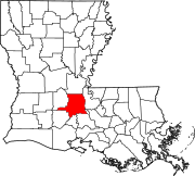
Morrow is an unincorporated community and census-designated place (CDP) in St. Landry Parish, Louisiana, United States, located just east of U.S. Route 71. It was first listed as a CDP in the 2020 census with a population of 149.
A post office has existed in this community since 1883.
Public school students in Morrow attended Morrow Elementary School (under the supervision of the St. Landry Parish School Board) until the school was closed due to dwindling school population and a federal desegregation order in 2009.
Morrow is served by St. Landry Parish Fire Protection District #7.
Demographics
| Census | Pop. | Note | %± |
|---|---|---|---|
| 2020 | 159 | — | |
| U.S. Decennial Census 2020 | |||
2020 census
| Race / Ethnicity (NH = Non-Hispanic) | Pop 2020 | % 2020 |
|---|---|---|
| White alone (NH) | 22 | 14.77% |
| Black or African American alone (NH) | 122 | 81.88% |
| Native American or Alaska Native alone (NH) | 0 | 0.00% |
| Asian alone (NH) | 2 | 1.34% |
| Pacific Islander alone (NH) | 0 | 0.00% |
| Some Other Race alone (NH) | 0 | 0.00% |
| Mixed Race or Multi-Racial (NH) | 3 | 2.01% |
| Hispanic or Latino (any race) | 0 | 0.00% |
| Total | 149 | 100.00% |
References
- ^ "GNIS Detail - Morrow".
- "Morrow CDP, Louisiana". United States Census Bureau. Retrieved April 7, 2022.
- "PO Locator | USPS".
- http://www.klfy.com/Global/story.asp?S=10399071
- "Morrow Elementary....Future Site of Juvenile Detention Center? | KATC.com | Acadiana-Lafayette, Louisiana". Archived from the original on January 2, 2014. Retrieved January 2, 2014.
- Ardoin, Bobby "Abandoned St. Landry school likely unsafe, difficult to sell, expensive to demolish" Daily WOrld (Jan. 27, 2022) (Accessed Dec. 24, 2022)
- "Boards & Commissions". www.stlandryparishgovernment.org. Archived from the original on February 25, 2012.
- "Decennial Census of Population and Housing by Decades". US Census Bureau.
- ^ "P2 Hispanic or Latino, and Not Hispanic or Latino by Race – 2020: DEC Redistricting Data (PL 94-171) – Morrow CDP, Louisiana". United States Census Bureau.
| Municipalities and communities of St. Landry Parish, Louisiana, United States | ||
|---|---|---|
| Parish seat: Opelousas | ||
| Cities |  | |
| Towns | ||
| Villages | ||
| CDPs | ||
| Other communities | ||
| Footnotes | ‡This populated place also has portions in an adjacent parish or parishes | |