You can help expand this article with text translated from the corresponding article in Italian. (January 2022) Click for important translation instructions.
|
| Montecopiolo | |
|---|---|
| Comune | |
| Comune di Montecopiolo | |
 | |
 Coat of arms Coat of arms | |
| Location of Montecopiolo | |
  | |
| Coordinates: 43°50′N 12°22′E / 43.833°N 12.367°E / 43.833; 12.367 | |
| Country | Italy |
| Region | Emilia-Romagna |
| Province | Rimini (RN) |
| Frazioni | Badia, Belvedere, Calvillano, Ca' Moneta, Pugliano, Ca' Bernacchia, Campo D'Arco, Casentino, Santa Rita, Villagrande (township's seat) |
| Government | |
| • Mayor | Alfonso Lattanzi |
| Area | |
| • Total | 35.7 km (13.8 sq mi) |
| Elevation | 915 m (3,002 ft) |
| Population | |
| • Total | 2,158 |
| • Density | 60/km (160/sq mi) |
| Demonym(s) | Villagrandesi (township frazione), Montecopiolesi (residents in the commune) |
| Time zone | UTC+1 (CET) |
| • Summer (DST) | UTC+2 (CEST) |
| Postal code | 61014 |
| Dialing code | 0722 |
| Website | Official website |
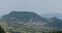
Montecopiolo is a comune (municipality) in the Province of Rimini in the Italian region Emilia-Romagna, located about 139 kilometres (86 mi) southeast of Bologna and about 29 kilometres (18 mi) west of Rimini. It is formed by several villages, none exactly called Montecopiolo; the communal seat is in Villagrande.
On June 24-25, 2007, Montecopiolo, alongside the nearby comune of Sassofeltrio, voted in a referendum to detach from neighboring Province of Pesaro and Urbino in Marche region, it came into effect 14 years later on June 17, 2021.
Montecopiolo borders the following municipalities: Carpegna, Macerata Feltria, Maiolo, Monte Cerignone, Monte Grimano, Pennabilli, Pietrarubbia, San Leo. It is home to a hill castle, built in the 10th century, at 1,030 metres (3,380 ft) above sea level.
Twin towns
 Mont-Saint-Martin, France
References
- "Superficie di Comuni Province e Regioni italiane al 9 ottobre 2011". Italian National Institute of Statistics. Retrieved 16 March 2019.
- All demographics and other statistics: Italian statistical institute Istat.
- "Gazzetta Ufficiale". www.gazzettaufficiale.it. Retrieved 2023-05-30.
This Marche location article is a stub. You can help Misplaced Pages by expanding it. |