| This article needs additional citations for verification. Please help improve this article by adding citations to reliable sources. Unsourced material may be challenged and removed. Find sources: "Minamikoma District, Yamanashi" – news · newspapers · books · scholar · JSTOR (September 2012) (Learn how and when to remove this message) |
You can help expand this article with text translated from the corresponding article in Japanese. (April 2023) Click for important translation instructions.
|

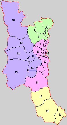
- Hayakawa
- Minobu
- Nanbu
- Fujikawa

Minamikoma (南巨摩郡, Minamikoma-gun) is a rural district located in southern Yamanashi Prefecture, Japan.
As of 1 October 2020, the district had an estimated population of 33,136 with a density of 33,65 persons per km. The total area is 984.8 km.
Municipalities
The district consists of four towns:
- Notes
History
| This list is incomplete; you can help by adding missing items. (March 2023) |
District Timeline
Minamikoma District was founded from the split of Koma District during the early Meiji period establishment of the municipalities system on July 22, 1878 and initially consisted of 22 villages.
Recent mergers
- On March 1, 2003 - The town of Tomizawa was merged into the expanded town of Nanbu.
- On September 13, 2004 - The towns of Nakatomi and Shimobe (from Nishiyatsushiro District) were merged into the expanded town of Minobu.
- On March 8, 2010 - The towns of Masuho and Kajikazawa were merged to form the new town of Fujikawa.
References
- "Minamikoma (District (-gun), Yamanashi, Japan) - Population Statistics, Charts, Map and Location". www.citypopulation.de. Retrieved 2023-10-13.
- 矢野恒太記念会 (2021-12-01). データでみる県勢2022: 日本国勢図会地域統計版 (in Japanese). 矢野恒太記念会. p. 504. ISBN 978-4-87549-347-1.
2010 年 3 月 8 日山梨県増穂町、鰍沢町が合併、富士川町に。
| Kōfu (capital) | ||
| Core city | ||
| Cities | ||
| Districts | ||
| Former Districts | ||
| List of mergers in Yamanashi Prefecture | ||
35°25′01″N 138°24′43″E / 35.417°N 138.412°E / 35.417; 138.412
This article about a location in Yamanashi Prefecture is a stub. You can help Misplaced Pages by expanding it. |