District of Balochistan in Pakistan
| Mastung District
ضلع مستونگ مستونگ دمگ | |
|---|---|
| District of Balochistan | |
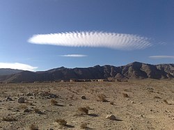
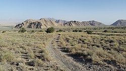
  Top: Mountains near Dasht Top: Mountains near DashtBottom: Koh-i-Chiltan | |
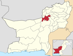
 Map of Balochistan with Mastung District highlighted Map of Balochistan with Mastung District highlighted | |
| Coordinates: 29°48′N 66°51′E / 29.80°N 66.85°E / 29.80; 66.85 | |
| Country | |
| Province | |
| Division | Kalat |
| Established | 1991 |
| Headquarters | Mastung |
| Administrative Areas |
04
|
| Government | |
| • Type | District Administration |
| • Deputy Commissioner | Captain (R) Mir Baz Khan Marri |
| • Constituensy | NA-261 Surab-cum-Kalat-cum-Mastung |
| Area | |
| • Total | 5,896 km (2,276 sq mi) |
| Elevation | 1,701 m (5,581 ft) |
| Population | |
| • Total | 313,271 |
| • Density | 53/km (140/sq mi) |
| Time zone | UTC+05:00 (PKT) |
| • Summer (DST) | DST is not observed |
| ZIP Code | 88200 |
| NWD (area) code | 843 |
| ISO 3166 code | PK-BA |
Mastung District (Balochi: مستونگ دمگ; Brahui and Urdu: ضلع مستونگ) is a district located in the northwest of Balochistan province, Pakistan. Prior to its creation as a separate district in 1991, Mastung was part of Kalat District.
District Mastung published its Gazetteer in the year, 2020. It was compiled by the then Deputy Commissioner Mastung, Mr. Mehboob Achakzai (PAS).
Administration
The district consists of following Tehsils:
| Tehsil | Area
(km²) |
Pop.
(2023) |
Density
(ppl/km²) (2023) |
Literacy rate
(2023) |
Union Councils |
|---|---|---|---|---|---|
| Dasht Mastung Tehsil | 1,047 | 67,935 | 64.89 | 36.79% | |
| Mastung Tehsil | 692 | 162,319 | 234.57 | 53.70% | |
| Khad Koocha Tehsil | 640 | 46,316 | 72.37 | 33.22% | |
| Kardigap Tehsil | 929 | 36,701 | 39.51 | 42.71% |
Prior to 2006, the three tehsils contained 12 union councils: Khadkoocha, Ghulam Parenz, Karez Noth, Mastung-1, Mastung-2, Sorgaz, Tehsil Dasht, Isplinji, Kanak, Shaikh Wasil, Kardigap and Soro. In 2006, one additional union council formed with the name of Alizai, making the total union councils to 13.
Demographics
Population
| Year | Pop. | ±% p.a. |
|---|---|---|
| 1951 | N/A | — |
| 1961 | N/A | — |
| 1972 | N/A | — |
| 1981 | N/A | — |
| 1998 | 150,039 | — |
| 2017 | 265,676 | +3.05% |
| 2023 | 313,271 | +2.78% |
| Sources: | ||
As of the 2023 census, Mastung district has 43,695 households and a population of 313,271. The district has a sex ratio of 113.70 males to 100 females and a literacy rate of 45.97%: 57.26% for males and 33.27% for females. 109,539 (35.07% of the surveyed population) are under 10 years of age. 40,374 (12.89%) live in urban areas. 1,696 (0.54% of the surveyed population) was from religious minorities, of which 900 were Hindus and 750 Christians.
Language
Languages of Mastung district (2023)
Brahui (89.05%) Balochi (7.19%) Pashto (2.12%) Others (1.64%)At the time of the 2023 census, 89.05% of the population spoke Brahui, 7.19% Balochi and 2.12% Pashto as their first language.
Education
According to the Pakistan District Education Rankings 2017, district Mastung is ranked at number 74 out of the 141 ranked districts in Pakistan on the education score index. This index considers learning, gender parity and retention in the district.
Literacy rate for 2014–15 of population 10 years and older in the district stands at 59% whereas for females it is only 38%.
Post primary access is a major issue in the district with 79% schools being at primary level. Compare this with high schools which constitute only 8% of government schools in the district. This is also reflected in the enrolment figures for 2016–17 with 15,842 students enrolled in class 1 to 5 and only 642 students enrolled in class 9 and 10.
Gender disparity is another issue in the district. Only 36% schools in the district are girls’ schools. Access to education for girls is a major issue in the district and is also reflected in the low literacy rates for females.
Moreover, the schools in the district lack basic facilities. According to Alif Ailaan district education rankings 2017, the district is ranked at number 107 out of the 155 districts of Pakistan for primary school infrastructure. At the middle school level, it is ranked at number 115 out of the 155 districts. These rankings take into account the basic facilities available in schools including drinking water, working toilet, availability of electricity, existence of a boundary wall and general building condition. 4 out of 5 schools do not have electricity in them. More than half the schools lack a toilet and 1 out 3 schools do not have a boundary wall. 3 out of 5 schools do not have clean drinking water.
Notable people
- Malik Saeed Dehwar
- Nawab Muhammad Aslam Raisani
- Nawab Muhammad Khan Shahwani
- Sardar Kamal Khan Bangulzai
- Sardar Noor Ahmed Bangulzai
- Sardar Muhammad Afzal Dehwar
- Sardar Sher Khan Pirkani
- Sardar Asim Sarparah
See also
- 2017 Mastung suicide bombing
- Mastung Valley
- Dehwar Tribe
- Shahwani Tribe
- Bangulzai Tribe
- Raisani Tribe
- Sarparah Tribe
- Kurd Tribe
References
- "Population by Sex, Religion and Rural/Urban, Census - 2023" (PDF). Pakistan Bureau of Statistics.
- "Tehsils & Unions in the District of Mastung". National Reconstruction Bureau - Government of Pakistan website. 9 February 2012. Archived from the original on 9 February 2012. Retrieved 28 March 2023.
- "TABLE 1 : AREA, POPULATION BY SEX, SEX RATIO, POPULATION DENSITY, URBAN POPULATION, HOUSEHOLD SIZE AND ANNUAL GROWTH RATE, CENSUS-2023, BALOCHISTAN" (PDF).
- "LITERACY RATE, ENROLMENT AND OUT OF SCHOOL POPULATION BY SEX AND RURAL/URBAN, CENSUS-2023, BALOCHISTAN" (PDF).
- "Population by administrative units 1951-1998" (PDF). Pakistan Bureau of Statistics.
- ^ "7th Population and Housing Census - Detailed Results: Table 1" (PDF). Pakistan Bureau of Statistics.
- "7th Population and Housing Census - Detailed Results: Table 12" (PDF). Pakistan Bureau of Statistics.
- "7th Population and Housing Census: Population by Mother Tongue, Sex and Rural/Urban" (PDF). Pakistan Bureau of Statistics.
- "7th Population and Housing Census - Detailed Results: Table 9" (PDF). Pakistan Bureau of Statistics.
- ^ "Population by Mother Tongue, Sex and Rural/Urban, Census-2023" (PDF). Pakistan Bureau of Statistics.
- Pakistan Bureau of Statistics (2016). Pakistan Social and Living Standards Measurement Survey 2014-15.Islamabad: Government of Pakistan, p.111. Archived 14 November 2018 at the Wayback Machine .
External links
| Districts of Balochistan, Pakistan | ||
|---|---|---|
| Provincial capital: Quetta | ||
| Kalat |  | |
| Makran | ||
| Nasirabad | ||
| Quetta | ||
| Sibi | ||
| Zhob | ||
| Rakhshan | ||
| Loralai | ||
| - formerly part of Quetta Division; - formerly part of Kalat Division; - formerly part of Zhob Division ; - abolished | ||