| Machakhela National Park | |
|---|---|
| IUCN category II (national park) | |
 Machakhela National Park landscape Machakhela National Park landscape | |
  | |
| Location | |
| Nearest city | Batumi |
| Coordinates | 41°31′12.92″N 41°43′10.81″E / 41.5202556°N 41.7196694°E / 41.5202556; 41.7196694 |
| Area | 130.7 km (50.5 sq mi) |
| Established | 2012 |
| Governing body | Agency of Protected Areas |
| Website | Machakhela National Park |
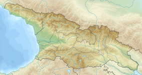
Machakhela National Park (Georgian: მაჭახელას ეროვნული პარკი) is a national park in Adjara, in the valley of Machakhlistskali, Georgia. The park was established in 2012 with an area of 8733 ha (hectares).
Machakhela National Park provides for the preservation of unique biological and landscape biodiversity, the long-term protection of ecosystem of Colchic forests, ecological safety and natural and environmental tourism and recreational activities.
Tourist attractions
Machakhela National Park region features ruins of fortresses in historic region of Machakheli, arch bridges and wine presses. From the slopes of Mtavarangelozi mountain there are views of Batumi and Machakhela gorge. Park visitor center is located in village Acharisagmarti, Khelvachauri Municipality.
See also
References
- ^ Machakhela in Georgia Protected Planet
- Georgian forests and wetlands to be included among UNESCO World Heritage Sites Georgia Journal 15 February 2018
- Machakhela National Park