Misplaced Pages

List of national parks of Finland

Article snapshot taken from Wikipedia with creative commons attribution-sharealike license. Give it a read and then ask your questions in the chat. We can research this topic together.

Part of a series on the
Culture of Finland
History
People
Languages
Mythology and folklore
Cuisine
Festivals
Religion
Art
Literature
Music
Media
Sport
Monuments
Symbols
Map all coordinates using OpenStreetMap

Download coordinates as:

There are 41 national parks in Finland. They are all managed by the Metsähallitus. The national parks cover a total area of 9,892 square kilometres (3,819 sq mi) – 2.7% of Finland's total land area.

A total of 3.2 million people visited the parks in 2018. During the COVID-19 pandemic, the number of national park visitors strongly increased, with a total of 8.5 million people visiting the parks in 2021.

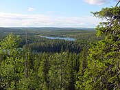
Lake Pielinen seen from a hill in Koli National Park.

List of national parks

National park Photo Region Land area (km) Established Visitation (2021) Coordinates
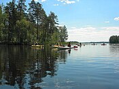
Archipelago Southwest Finland 500 1982 84,000 59°54′53″N 21°52′39″E / 59.91472°N 21.87750°E / 59.91472; 21.87750 (Archipelago National Park)
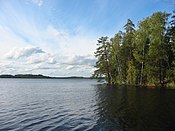
Bothnian Bay Lapland 2.5 1991 6,300 65°37′N 024°19′E / 65.617°N 24.317°E / 65.617; 24.317 (Perämeri National Park)
Teijo Southwest Finland 33.85 2015 104,700 60°13′26″N 022°57′37″E / 60.22389°N 22.96028°E / 60.22389; 22.96028 (Teijo National Park)
Salla Lapland 99.83 2022
Bothnian Sea Southwest Finland & Satakunta 913 2011 95,300 61°32′06″N 21°33′50″E / 61.53500°N 21.56389°E / 61.53500; 21.56389 (Bothnian Sea National Park)
Eastern Gulf of Finland Kymenlaakso 6.7 1982 16,300 60°17′5″N 27°16′26″E / 60.28472°N 27.27389°E / 60.28472; 27.27389 (Eastern Gulf of Finland National Park)
Ekenäs Archipelago Uusimaa 52 1989 59,400 59°49′22″N 23°27′15″E / 59.82278°N 23.45417°E / 59.82278; 23.45417 (Ekenäs Archipelago National Park)
Helvetinjärvi Pirkanmaa 49.8 1982 67,000 62°2′N 23°51′E / 62.033°N 23.850°E / 62.033; 23.850 (Helvetinjärvi National Park)
Hiidenportti Kainuu 45 1982 15,000 63°52′22″N 29°3′31″E / 63.87278°N 29.05861°E / 63.87278; 29.05861 (Hiidenportti National Park)
Hossa Kainuu 11 2017 112,900 65°29′23″N 29°19′25″E / 65.48972°N 29.32361°E / 65.48972; 29.32361 (Hossa National Park)
Isojärvi Central Finland 19 1982 30,200 61°41′54″N 25°0′39″E / 61.69833°N 25.01083°E / 61.69833; 25.01083 (Isojärvi National Park)
Kauhaneva-Pohjankangas Southern Ostrobothnia / Satakunta 57 1982 29,700 62°10′45″N 22°24′23″E / 62.17917°N 22.40639°E / 62.17917; 22.40639 (Kauhaneva-Pohjankangas National Park)
Koli North Karelia 30 1991 256,900 63°3′27″N 29°53′14″E / 63.05750°N 29.88722°E / 63.05750; 29.88722 (Koli National Park)
Kolovesi Southern Savonia 23 1990 17,200 62°15′27″N 28°49′0″E / 62.25750°N 28.81667°E / 62.25750; 28.81667 (Kolovesi National Park)
Southern Konnevesi Central Finland / Northern Savonia 15.44 2014 38,600 62°33′30″N 26°38′50″E / 62.55833°N 26.64722°E / 62.55833; 26.64722 (Southern Konnevesi National Park)
Kurjenrahka Southwest Finland 29 1998 77,600 60°43′14″N 22°23′1″E / 60.72056°N 22.38361°E / 60.72056; 22.38361 (Kurjenrahka National Park)
Lauhanvuori Southern Ostrobothnia 53 1982 20,500 62°09′7″N 22°10′30″E / 62.15194°N 22.17500°E / 62.15194; 22.17500 (Lauhanvuori National Park)
Leivonmäki Central Finland 29 2003 33,400 61°56′N 26°2′E / 61.933°N 26.033°E / 61.933; 26.033 (Leivonmäki National Park)
Lemmenjoki Lapland 2,850 1956 29,500 68°30′N 25°30′E / 68.500°N 25.500°E / 68.500; 25.500 (Lemmenjoki National Park)
Liesjärvi Tavastia Proper 22 1956 60,100 60°40′50″N 23°51′30″E / 60.68056°N 23.85833°E / 60.68056; 23.85833 (Liesjärvi National Park)
Linnansaari Southern Savonia / Northern Savonia 38 1956 36,000 62°6′38″N 28°30′34″E / 62.11056°N 28.50944°E / 62.11056; 28.50944 (Linnansaari National Park)
Nuuksio Uusimaa 45 1994 314,500 60°18′27″N 24°29′57″E / 60.30750°N 24.49917°E / 60.30750; 24.49917 (Nuuksio National Park)
Oulanka Northern Ostrobothnia / Lapland 270 1956 253,300 66°22′32″N 29°20′19″E / 66.37556°N 29.33861°E / 66.37556; 29.33861 (Oulanka National Park)
Päijänne Päijänne Tavastia 14 1993 15,000 61°23′12″N 25°23′36″E / 61.38667°N 25.39333°E / 61.38667; 25.39333 (Päijänne National Park)
Pallas-Yllästunturi Lapland 1,020 2005 699,200 68°9′32″N 24°2′25″E / 68.15889°N 24.04028°E / 68.15889; 24.04028 (Pallas-Yllästunturi National Park)
Patvinsuo North Karelia 105 1982 20,200 63°6′41″N 30°42′16″E / 63.11139°N 30.70444°E / 63.11139; 30.70444 (Patvinsuo National Park)
Petkeljärvi North Karelia 6 1956 29,800 62°35′N 31°11′E / 62.583°N 31.183°E / 62.583; 31.183 (Petkeljärvi National Park)
Puurijärvi-Isosuo Pirkanmaa / Satakunta 27 1993 21,700 61°14′57″N 22°34′1″E / 61.24917°N 22.56694°E / 61.24917; 22.56694 (Puurijärvi-Isosuo National Park)
Pyhä-Häkki Central Finland 13 1956 21,400 62°50′44″N 25°28′21″E / 62.84556°N 25.47250°E / 62.84556; 25.47250 (Pyhä-Häkki National Park)
Pyhä-Luosto Lapland 142 2005 232,700 67°3′59″N 26°58′25″E / 67.06639°N 26.97361°E / 67.06639; 26.97361 (Pyhä-Luosto National Park)
Repovesi Kymenlaakso / Southern Savonia 15 2003 172,900 61°11′N 26°53′E / 61.183°N 26.883°E / 61.183; 26.883 (Repovesi National Park)
Riisitunturi Lapland 77 1982 89,900 66°14′N 28°30′E / 66.233°N 28.500°E / 66.233; 28.500 (Riisitunturi National Park)
Rokua Northern Ostrobothnia / Kainuu 4.3 1956 62,600 64°33′22″N 26°30′36″E / 64.55611°N 26.51000°E / 64.55611; 26.51000 (Rokua National Park)
Salamajärvi Central Ostrobothnia / Central Finland 62 1982 22,400 63°16′N 24°45′E / 63.267°N 24.750°E / 63.267; 24.750 (Salamajärvi National Park)
Seitseminen Pirkanmaa 45.5 1982 48,200 61°56′N 23°26′E / 61.933°N 23.433°E / 61.933; 23.433 (Seitseminen National Park)
Sipoonkorpi Uusimaa 18.6 2011 146,400 60°18′54″N 25°13′8″E / 60.31500°N 25.21889°E / 60.31500; 25.21889 (Sipoonkorpi National Park)
Syöte Northern Ostrobothnia / Lapland 299 2000 117,800 65°44′51″N 27°54′43″E / 65.74750°N 27.91194°E / 65.74750; 27.91194 (Syöte National Park)
Tiilikkajärvi Northern Savonia / Kainuu 34 1982 25,300 63°40′N 28°18′E / 63.667°N 28.300°E / 63.667; 28.300 (Tiilikkajärvi National Park)
Torronsuo Tavastia Proper 25.5 1990 55,500 60°44′N 23°37′E / 60.733°N 23.617°E / 60.733; 23.617 (Torronsuo National Park)
Urho Kekkonen Lapland 2,550 1983 446,300 68°13′5″N 28°8′25″E / 68.21806°N 28.14028°E / 68.21806; 28.14028 (Urho Kekkonen National Park)
Valkmusa Kymenlaakso 17 1996 25,400 60°34′N 26°44′E / 60.567°N 26.733°E / 60.567; 26.733 (Valkmusa National Park)

See also

Other references on Misplaced Pages:

References

  1. "The economic and health impacts of Finnish national parks increased in 2018 – positive development at risk without increase in funding". Metsähallitus. 2019-01-31. Archived from the original on 2019-04-22. Retrieved January 31, 2019.
  2. "Käyntimäärät Maastossa". metsa.fi (in Finnish). Archived from the original on 16 December 2021. Retrieved 23 June 2022.
  3. "Käyntimäärät Maastossa". metsa.fi (in Finnish). Archived from the original on 16 December 2021. Retrieved 23 June 2022.

External links

Finland articles
History
Geography
Politics
Economy
Society
Culture
List of national parks of Europe
Sovereign states
States with limited
recognition
Categories:
List of national parks of Finland Add topic