Tunnel
Canal
Length
Designer
Coordinates
Notes
Image
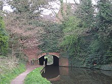
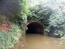
Ashford Tunnel
Monmouthshire and Brecon Canal
375 yards (343 m)
Thomas Dadford
51°53.195′N 3°16.525′W / 51.886583°N 3.275417°W / 51.886583; -3.275417 (Ashford)
Brecknockshire /Powys Tunnel narrows considerably between northern and southern portals due to repairs to its fabric but is nevertheless navigable by a narrowboat with relative ease.
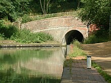
Ashford Tunnel, northern portal
Ashperton Tunnel
Herefordshire and Gloucestershire Canal
400 yards (370 m)
Aylestone Tunnel
Herefordshire and Gloucestershire Canal
440 yards (400 m)
Berwick Tunnel
Shrewsbury Canal
970 yards (890 m)
Josiah Clowes
52°42′4.97″N 2°41′22.22″W / 52.7013806°N 2.6895056°W / 52.7013806; -2.6895056 (Berwick)
Claimed to be the first canal tunnel with a towpath throughout.
Berwick Tunnel, northern portal
Blisworth Tunnel
Grand Union Canal
3,056 yards (2,794 m)
Northamptonshire
Blisworth Tunnel, southern portal
Branwood Tunnel
Stratford-upon-Avon Canal
352 yards (322 m)
Brandwood Tunnel, eastern portal
Braunston Tunnel
Grand Union Canal
2,042 yards (1,867 m)
Jessop & Barnes
52°16.976′N 1°10.041′W / 52.282933°N 1.167350°W / 52.282933; -1.167350 (Braunston)
Northamptonshire
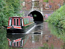
Narrowboat leaving Braunston Tunnel
Bruce Tunnel
Kennet and Avon Canal
502 yards (459 m)
Bruce Tunnel's Eastern Portal (in 1992)
Butterley Tunnel
Cromford Canal
3,063 yards (2,801 m)
53°3.3841′N 1°22.3994′W / 53.0564017°N 1.3733233°W / 53.0564017; -1.3733233 (Butterley)
Derbyshire
The Butterley Reservoir Adit where it enters the Butterley Tunnel, in 2006
Chirk Tunnel
Llangollen Canal
459 yards (420 m)
52°55′46.91″N 3°3′46.77″W / 52.9296972°N 3.0629917°W / 52.9296972; -3.0629917 (Chirk)
Near Chirk
View taken from the Chirk Aqueduct
Cookley Tunnel
Staffordshire & Worcestershire Canal
65 yards (59 m)
Cookley Tunnel, western portal
Drakeholes Tunnel
Chesterfield Canal
154 yards (141 m)
Dudley Tunnel
Birmingham Canal Navigations
3,172 yards (2,900 m)
52°31′18″N 2°04′42″W / 52.52173°N 2.07840°W / 52.52173; -2.07840 (Dudley)
Part of Dudley Canal Line No 1
The southern portal of the Dudley Tunnel
Dunsley Tunnel
Staffordshire & Worcestershire Canal
25 yards (23 m)
52°27′25″N 2°12′34″W / 52.4568191°N 2.2093904°W / 52.4568191; -2.2093904 (Dunsley)
Dunsley Tunnel, west portal, near Kinver
Edgbaston Tunnel
Worcester and Birmingham Canal
105 yards (96 m)
Foulridge Tunnel
Leeds and Liverpool Canal
1,630 yards (1,490 m)
Robert Whitworth /Samuel Fletcher
53°52′28″N 2°10′56″W / 53.8745°N 2.1821°W / 53.8745; -2.1821 (Foulridge)
Also known as the Mile Tunnel
Southern portal, Foulridge Tunnel
Gosty Hill Tunnel
Birmingham Canal Navigations
557 yards (509 m)
Part of Dudley Canal Line No 2
Gosty Hill Tunnel, northern portal
Greywell Tunnel
Basingstoke Canal
1,200 yards (1,100 m)
Closed to traffic following cave-in. Now home to Europe's largest bat colony.
The eastern portal of Greywell Tunnel on the Basingstoke Canal
Hardham Tunnel
Arun Navigation
375 yards (343 m)
50°56′56″N 0°31′23″W / 50.94889°N 0.52306°W / 50.94889; -0.52306 (Hardham)
Closed since 1888; blocked in 1895 by LBSCR under Mid Sussex Line and Midhurst-Pulborough Line .
Southern Portal, Hardham Tunnel.
Harecastle Tunnel
Trent & Mersey Canal
2,926 yards (2,676 m)
James Brindley /Thomas Telford
53°4′27″N 2°14′11″W / 53.07417°N 2.23639°W / 53.07417; -2.23639 (Harecastle)
Staffordshire . Comprises parallel "Brindley" and "Telford" tunnels. (The length stated is for the Telford tunnel.)
Northern end of Harecastle Tunnel. Telford's tunnel on the left, Brindley's the right.
Hincaster Tunnel
Lancaster Canal
378 yards (346 m)
Thomas Fletcher
54°15′33″N 2°45′18″W / 54.25917°N 2.75500°W / 54.25917; -2.75500 (Hincaster)
Opened in 1819. Commercial traffic on the Lancaster Canal ceased north of Lancaster in 1944 and this part of the canal was officially closed following the Transport Act, 1955.
Lapal Tunnel
Birmingham Canal Navigations
3,795 yards (3,470 m)
52°26′42″N 2°00′06″W / 52.4450°N 2.0017°W / 52.4450; -2.0017 (Lapal)
Part of Dudley Canal Line No 2 (disused—closed 1907)
1955 Ordnance Survey map of the east portal of Lapal Tunnel
Lord Ward's Tunnel
Birmingham Canal Navigations
196 yards (179 m)
In the Dudley Tunnel complex
Netherton Tunnel
Birmingham Canal Navigations
3,027 yards (2,768 m)
52°30′25″N 2°03′25″W / 52.50697°N 2.05708°W / 52.50697; -2.05708 (Netherton)
The dual towpaths inside the northern portal of Netherton Tunnel
Newbold Tunnel
Oxford Canal
250 yards (230 m)
Illuminated Newbold Tunnel
Newnham Tunnel
Leominster Canal
100 yards (91 m)
52°19′37″N 2°31′20″W / 52.32685°N 2.52223°W / 52.32685; -2.52223 (Newnham)
Worcestershire
Norwood Tunnel
Chesterfield Canal
2,884 yards (2,637 m)
James Brindley
53°20′06″N 1°16′11″W / 53.33501°N 1.26971°W / 53.33501; -1.26971 (Norwood)
Derbyshire to South Yorkshire . Closed with plans for partial restoration of eastern end.
Norwood Tunnel western portal
Oxenhall Tunnel
Herefordshire and Gloucestershire Canal
2,192 yards (2,004 m)
Pensax Tunnel
Leominster Canal
3,850 yards (3,520 m)
52°19′22″N 2°23′27″W / 52.32265°N 2.39083°W / 52.32265; -2.39083 (Pensax)
Worcestershire
Abandoned during construction.
Putnall Tunnel
Leominster Canal
330 yards (300 m)
52°17′38″N 2°43′58″W / 52.29398°N 2.73266°W / 52.29398; -2.73266 (Putnall)
Herefordshire
Sapperton Canal Tunnel
Thames and Severn Canal
3,817 yards (3,490 m)
Josiah Clowes
51°42′45″N 2°03′42″W / 51.7126°N 2.0618°W / 51.7126; -2.0618 (Sapperton)
Gloucestershire
The Coates Portal at the south-eastern end of the Sapperton Canal Tunnel.
Scout Tunnel
Huddersfield Narrow Canal
220 yards (200 m)
Unlined, rock tunnel
Scout Tunnel
Shortwood Tunnel
Worcester and Birmingham Canal
613 yards (561 m)
Southnett Tunnel
Leominster Canal
1,250 yards (1,140 m)
52°19′43″N 2°28′37″W / 52.32874°N 2.47691°W / 52.32874; -2.47691 (Southnett)
Herefordshire
Standedge Tunnels
Huddersfield Narrow Canal
5,698 yards (5,210 m)
53°35′29″N 1°57′36″W / 53.591283°N 1.95996°W / 53.591283; -1.95996 (Standedge)
West Yorkshire to Greater Manchester
Standedge Tunnel entrance at Marsden
Strood Tunnel
Thames and Medway Canal
3,946 yards (3,608 m)
Ralph Walker
51°24′54″N 0°28′52″E / 51.4149°N 0.4812°E / 51.4149; 0.4812 (Strood)
Kent
Tardebigge Tunnel
Worcester and Birmingham Canal
580 yards (530 m)
Wast Hills Tunnel
Worcester and Birmingham Canal
2,726 yards (2,493 m)
52°23′25″N 1°56′24″W / 52.3902°N 1.9400°W / 52.3902; -1.9400 (Wast Hills)
West Midlands (county) to Worcestershire
Wast Hills Tunnel, southern portal 