Landmark name
Image
Date designated
Location
Neighborhood
Description
1
Academy of Music
Academy of Music More images
December 29, 1962(#66000674 )
Center City 39°56′53″N 75°09′54″W / 39.9481°N 75.165°W / 39.9481; -75.165 (Academy of Music) Rittenhouse Square West
Former longtime home of the Philadelphia Orchestra and current home of the Pennsylvania Ballet and the Opera Company of Philadelphia . The oldest opera house in the United States that is still used for its original purpose.
2
American Philosophical Society Hall
American Philosophical Society Hall More images
January 12, 1965(#66000675 )
Center City 39°56′56″N 75°08′59″W / 39.9489°N 75.1497°W / 39.9489; -75.1497 (American Philosophical Society Hall) Independence Mall
Society founded 1743 by Benjamin Franklin . Building erected 1768. Early members included George Washington , John Adams , and Thomas Jefferson .
3
Arch Street Friends Meeting House
Arch Street Friends Meeting House More images
June 23, 2011(#71000716 )
Center City 39°57′07″N 75°08′50″W / 39.9519°N 75.1472°W / 39.9519; -75.1472 (Arch Street Friends Meeting House) Independence Mall
Built by noted Federal period architect Owen Biddle. In continuous use since 1805. The largest Quaker meeting house in the country.
4
Athenaeum
Athenaeum More images
December 8, 1976(#72001144 )
Center City 39°56′48″N 75°09′06″W / 39.9467°N 75.1517°W / 39.9467; -75.1517 (Athenaeum) Washington Square East
A special collections library founded in 1814. The building was designed in 1845 by John Notman .
5
John Bartram House
John Bartram House More images
October 9, 1960(#66000676 )
Southwest Philadelphia 39°55′54″N 75°12′43″W / 39.9317°N 75.2119°W / 39.9317; -75.2119 (John Bartram House) Bartram Village
Home of colonial-era botanist John Bartram and son William Bartram , and the oldest surviving botanic garden in North America.
6
Boathouse Row
Boathouse Row More images
February 27, 1987(#87000821 )
North Philadelphia Kelly Drive 39°58′14″N 75°11′14″W / 39.97056°N 75.1872°W / 39.97056; -75.1872 (Boathouse Row) Fairmount
A row of fifteen historic boathouses along the Schuylkill River . The Schuylkill Navy is based here. Architect Frank Furness and the Undine Barge Club have association with this site.
7
Carpenters' Hall
Carpenters' Hall More images
April 15, 1970(#70000552 )
Center City 39°56′53″N 75°08′50″W / 39.9481°N 75.1472°W / 39.9481; -75.1472 (Carpenters' Hall) Independence Mall
The First Continental Congress met here.
8
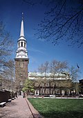
Christ Church
Christ Church More images
April 15, 1970(#70000553 )
Center City 39°57′03″N 75°08′37″W / 39.9508°N 75.1436°W / 39.9508; -75.1436 (Christ Church) Old City
Founded 1695. First Episcopal Church in the country. Built 1727–1744.
9
Church of the Advocate
Church of the Advocate More images
June 19, 1996(#80003620 )
North Philadelphia 39°59′09″N 75°09′49″W / 39.9858°N 75.1636°W / 39.9858; -75.1636 (Church of the Advocate) North Philadelphia
Built 1887–1897. The site in 1974 of the first ordinations of women as priests in the Episcopal Church.
10
Cliveden
Cliveden More images
January 20, 1961(#66000677 )
Northwest Philadelphia 40°02′50″N 75°10′54″W / 40.0472°N 75.1817°W / 40.0472; -75.1817 (Cliveden) Mt. Airy
The scene of fighting at the Battle of Germantown .
11
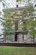
The College of Physicians of Philadelphia Building
The College of Physicians of Philadelphia Building More images
October 6, 2008(#08001088 )
Center City 39°57′12″N 75°10′36″W / 39.9533°N 75.1767°W / 39.9533; -75.1767 (The College of Physicians of Philadelphia Building) Rittenhouse Square West
12
Colonial Germantown Historic District
Colonial Germantown Historic District More images
June 23, 1965(#66000678 )
Northwest Philadelphia 40°02′11″N 75°10′29″W / 40.0364°N 75.1747°W / 40.0364; -75.1747 (Colonial Germantown Historic District) Mt. Airy and Germantown
Associated with William Penn .
13
John Coltrane House
John Coltrane House More images
January 20, 1999(#99000628 )
North Philadelphia 39°58′49″N 75°11′21″W / 39.9803°N 75.1892°W / 39.9803; -75.1892 (John Coltrane House) Strawberry Mansion
A home of jazz saxophonist John Coltrane .
14
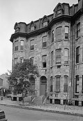
Edward D. Cope House
Edward D. Cope House More images
May 15, 1975(#75001660 )
Center City 39°56′49″N 75°10′36″W / 39.9469°N 75.1767°W / 39.9469; -75.1767 (Edward D. Cope House) Rittenhouse Square West
A home of paleontologist Edward Drinker Cope , who is listed in National Academy of Sciences .
15
Thomas Eakins House
Thomas Eakins House More images
December 21, 1965(#66000679 )
North Philadelphia 39°57′56″N 75°10′02″W / 39.9656°N 75.1672°W / 39.9656; -75.1672 (Thomas Eakins House) Spring Garden
Home of painter Thomas Eakins .
16
Eastern State Penitentiary
Eastern State Penitentiary More images
June 23, 1965(#66000680 )
North Philadelphia 39°58′05″N 75°10′23″W / 39.9681°N 75.1731°W / 39.9681; -75.1731 (Eastern State Penitentiary) Fairmount
Considered to be the world's first true penitentiary, designed by John Haviland .
17
Elfreth's Alley Historic District
Elfreth's Alley Historic District More images
October 9, 1960(#66000681 )
Center City 39°57′10″N 75°08′33″W / 39.9528°N 75.1425°W / 39.9528; -75.1425 (Elfreth's Alley Historic District) Old City
The country's oldest residential neighborhood in continuous use.
18
Fairmount Water Works
Fairmount Water Works More images
May 11, 1976(#76001662 )
North Philadelphia Schuylkill River 39°57′59″N 75°11′09″W / 39.9664°N 75.1858°W / 39.9664; -75.1858 (Fairmount Water Works) Fairmount Park
First municipal waterworks in the United States. Designed in 1812 by Frederick Graff and built between 1819 and 1822, it operated until 1909.
19
First Bank of the United States
First Bank of the United States More images
May 4, 1987(#87001292 )
Center City 39°56′53″N 75°08′47″W / 39.9481°N 75.1464°W / 39.9481; -75.1464 (First Bank of the United States) Independence Mall
Has association with Washington and Alexander Hamilton .
20
Fort Mifflin
Fort Mifflin More images
August 29, 1970(#70000554 )
Southwest Philadelphia 39°52′31″N 75°12′47″W / 39.87528°N 75.2131°W / 39.87528; -75.2131 (Fort Mifflin) Philadelphia International Airport
Revolutionary War-era fort on the Delaware River .
21
Founder's Hall, Girard College
Founder's Hall, Girard College More images
August 4, 1969(#69000158 )
North Philadelphia 39°58′26″N 75°10′12″W / 39.9739°N 75.17°W / 39.9739; -75.17 (Founder's Hall, Girard College) Girard College
Boarding school (K-12) for orphans established by the will of Stephen Girard .
22
Friends Hospital
Friends Hospital More images
January 20, 1999(#99000629 )
Northeast Philadelphia 40°01′36″N 75°06′07″W / 40.0267°N 75.1019°W / 40.0267; -75.1019 (Friends Hospital) Northwood
The first private psychiatric hospital in the U.S., founded in 1813 by the Quakers . Designed and/or influenced by William Tuke , York Retreat , and Thomas Scattergood .
23
Furness Library, School of Fine Arts, University of Pennsylvania
Furness Library, School of Fine Arts, University of Pennsylvania More images
February 4, 1985(#72001154 )
West Philadelphia 39°57′06″N 75°11′34″W / 39.9517°N 75.1928°W / 39.9517; -75.1928 (Furness Library, School of Fine Arts, University of Pennsylvania) University City
Library at the University of Pennsylvania, designed by Frank Furness .
24
Germantown (Manheim) Cricket Club
Germantown (Manheim) Cricket Club More images
February 27, 1987(#87000758 )
Northwest Philadelphia 40°01′25″N 75°10′24″W / 40.0236°N 75.1733°W / 40.0236; -75.1733 (Germantown (Manheim) Cricket Club) Germantown
Bill Tilden was a member.
25
Frances Ellen Watkins Harper House
Frances Ellen Watkins Harper House December 8, 1976(#76001663 )
South Philadelphia 39°56′31″N 75°09′34″W / 39.9419°N 75.1594°W / 39.9419; -75.1594 (Frances Ellen Watkins Harper House) Bella Vista
A home of Frances Harper
26
Hill-Keith-Physick House
Hill-Keith-Physick House More images
January 7, 1976(#71000726 )
Center City 39°56′40″N 75°08′54″W / 39.9444°N 75.1483°W / 39.9444; -75.1483 (Hill-Keith-Physick House) Society Hill
A home of Philip Syng Physick , "father of American surgery".
27
Institute of the Pennsylvania Hospital
Institute of the Pennsylvania Hospital More images
June 23, 1965(#66000684 )
West Philadelphia 39°57′42″N 75°13′02″W / 39.96167°N 75.2172°W / 39.96167; -75.2172 (Institute of the Pennsylvania Hospital) Mill Creek
Men's hospital built 1856–59. Plan influenced by Thomas Story Kirkbride .
28
Insurance Company of North America (INA) Building
Insurance Company of North America (INA) Building More images
June 2, 1978(#78002449 )
Center City 39°57′16″N 75°10′02″W / 39.9544°N 75.1672°W / 39.9544; -75.1672 (Insurance Company of North America (INA) Building) Logan Square
29
Johnson House
Johnson House More images
December 9, 1997(#72001162 )
Northwest Philadelphia 40°02′36″N 75°10′52″W / 40.0433°N 75.1811°W / 40.0433; -75.1811 (Johnson House) Germantown
Underground Railroad station house within the Colonial Germantown Historic District .
30
Laurel Hill Cemetery
Laurel Hill Cemetery More images
August 5, 1998(#77001185 )
North Philadelphia 40°00′15″N 75°11′19″W / 40.00417°N 75.1886°W / 40.00417; -75.1886 (Laurel Hill Cemetery) Fairmount Park
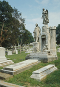
One of the first rural cemeteries , designed by John Notman .
31
J. Peter Lesley House
J. Peter Lesley House October 12, 1994(#94001646 )
Center City 39°56′43″N 75°09′31″W / 39.94528°N 75.1586°W / 39.94528; -75.1586 (J. Peter Lesley House) Washington Square West
A home of geologist J. Peter Lesley .
32
James Logan Home
James Logan Home More images
January 12, 1965(#66000690 )
North Philadelphia 40°01′29″N 75°09′13″W / 40.0247°N 75.1536°W / 40.0247; -75.1536 (James Logan Home) Logan
The colonial-era home of James Logan .
33
Memorial Hall
Memorial Hall More images
December 8, 1976(#76001665 )
West Philadelphia 39°58′46″N 75°12′35″W / 39.9794°N 75.2097°W / 39.9794; -75.2097 (Memorial Hall) Fairmount Park
Designed by Herman Schwartzmann for the 1876 Centennial Exposition .
34
Merchants' Exchange Building
Merchants' Exchange Building More images
August 7, 2001(#01001047 )
Center City 39°56′50″N 75°08′46″W / 39.9472°N 75.1461°W / 39.9472; -75.1461 (Merchants' Exchange Building) Independence Mall
Designed by William Strickland ; part of Independence National Historical Park
35
Mother Bethel A.M.E. Church
Mother Bethel A.M.E. Church More images
May 30, 1974(#72001166 )
Center City 39°56′35″N 75°09′09″W / 39.9431°N 75.1525°W / 39.9431; -75.1525 (Mother Bethel A.M.E. Church) Society Hill
African Methodist Episcopal church on Underground Railroad that was visited by Frederick Douglass , Lucretia Mott , Rosa Parks , and Colin Powell .
36
Mount Pleasant
Mount Pleasant More images
May 30, 1974(#66000685 )
North Philadelphia 39°59′00″N 75°12′00″W / 39.9833°N 75.2°W / 39.9833; -75.2 (Mount Pleasant) Fairmount Park
37
New Century Guild
New Century Guild November 4, 1993(#93001611 )
Center City 39°56′53″N 75°09′46″W / 39.948089°N 75.162694°W / 39.948089; -75.162694 (New Century Guild) Washington Square West
38
New Market
New Market More images
November 13, 1966(#66000686 )
Center City 39°56′35″N 75°08′43″W / 39.9431°N 75.1453°W / 39.9431; -75.1453 (New Market) Society Hill
39
Charles Willson Peale House
Charles Willson Peale House More images
December 21, 1965(#66000687 )
North Philadelphia 40°02′17″N 75°09′20″W / 40.0381°N 75.1556°W / 40.0381; -75.1556 (Charles Willson Peale House) Logan
A home of Charles Willson Peale who painted George Washington . Peale's sons Raphael , Rembrandt and Reubens Peale also became artists and have association with this site.
40
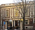
Pennsylvania Academy of the Fine Arts
Pennsylvania Academy of the Fine Arts More images
May 15, 1975(#71000731 )
Center City 39°57′19″N 75°09′48″W / 39.95528°N 75.1633°W / 39.95528; -75.1633 (Pennsylvania Academy of the Fine Arts) Hahnemann
41
Pennsylvania Hospital
Pennsylvania Hospital More images
June 22, 1965(#66000688 )
Center City 39°56′41″N 75°09′21″W / 39.9447°N 75.1558°W / 39.9447; -75.1558 (Pennsylvania Hospital) Washington Square West
Dr. Thomas Bond and Benjamin Franklin supported its development.
42
Philadelphia City Hall
Philadelphia City Hall More images
December 8, 1976(#76001666 )
Center City 39°57′08″N 75°09′49″W / 39.9522°N 75.1636°W / 39.9522; -75.1636 (Philadelphia City Hall) Market East
Designed by John McArthur Jr. ; decorated by Alexander Milne Calder , including sculpture of William Penn on top.
43
Philadelphia Contributionship
Philadelphia Contributionship More images
December 22, 1977(#71000732 )
Center City 39°56′49″N 75°08′54″W / 39.9469°N 75.1483°W / 39.9469; -75.1483 (Philadelphia Contributionship) Society Hill
The oldest property insurance company in the United States , founded in 1752 by Benjamin Franklin . Built 1836.
44
Philadelphia's Masonic Temple
Philadelphia's Masonic Temple More images
February 4, 1985(#71000727 )
Center City 39°57′13″N 75°09′46″W / 39.9536°N 75.1628°W / 39.9536; -75.1628 (Philadelphia's Masonic Temple) Market East
45
Philadelphia Savings Fund Society (PSFS) Building
Philadelphia Savings Fund Society (PSFS) Building More images
December 8, 1976(#76001667 )
Center City 39°57′06″N 75°09′38″W / 39.9517°N 75.1606°W / 39.9517; -75.1606 (Philadelphia Savings Fund Society (PSFS) Building) Market East
Designed by George Howe and William Lescaze .
46
Philadelphia School of Design for Women
Philadelphia School of Design for Women More images
November 4, 1993(#93001608 )
North Philadelphia 39°58′28″N 75°09′33″W / 39.9744°N 75.1592°W / 39.9744; -75.1592 (Philadelphia School of Design for Women) Cabot
Edwin Forrest House, first home of the Philadelphia School of Design for Women, founded in 1848 by Sarah Peter , the only women's art and design college in the nation.
47
Edgar Allan Poe House
Edgar Allan Poe House More images
December 29, 1962(#66000689 )
North Philadelphia 39°57′43″N 75°08′59″W / 39.961980°N 75.149748°W / 39.961980; -75.149748 (Edgar Allan Poe House) Callowhill
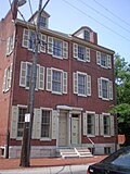
A home of Edgar Allan Poe .
48
Race Street Meetinghouse
Race Street Meetinghouse More images
November 4, 1993(#93001610 )
Center City 39°57′21″N 75°09′55″W / 39.9558°N 75.1653°W / 39.9558; -75.1653 (Race Street Meetinghouse) Hahnemann
Hicksites were here. Hannah Clothier Hull , Lucretia Mott , and Alice Paul have some association here.
49
Reading Terminal and Trainshed
Reading Terminal and Trainshed More images
December 8, 1976(#72001170 )
Center City 39°57′08″N 75°09′33″W / 39.9522°N 75.1592°W / 39.9522; -75.1592 (Reading Terminal and Trainshed) Philadelphia
Historic train depot, passenger station, and company headquarters of the Reading Railroad .
50
Reynolds-Morris House
Reynolds-Morris House More images
December 24, 1967(#67000020 )
Center City 39°56′51″N 75°09′16″W / 39.9475°N 75.1544°W / 39.9475; -75.1544 (Reynolds-Morris House) Society Hill
51
Alfred Newton Richards Medical Research Laboratories and David Goddard Laboratories Buildings
Alfred Newton Richards Medical Research Laboratories and David Goddard Laboratories Buildings More images
January 16, 2009(#09000081 )
West Philadelphia 39°56′59″N 75°11′53″W / 39.9497°N 75.1981°W / 39.9497; -75.1981 (Alfred Newton Richards Medical Research Laboratories and David Goddard Laboratories Buildings) University City
Two connected buildings on the University of Pennsylvania that were designed by Louis Kahn and built in the 1960s
52
Rittenhousetown Historic District
Rittenhousetown Historic District More images
April 27, 1992(#92001878 )
Northwest Philadelphia 40°01′43″N 75°11′28″W / 40.0286°N 75.1911°W / 40.0286; -75.1911 (Rittenhousetown Historic District) Fairmount Park
Site of British North America's first paper mill. The mill was built in Germantown by William Rittenhouse and his son Nicholas in 1690. Six of the mill town's forty-plus buildings stand today. They include the 1707 Homestead which was the 1732 birthplace of David Rittenhouse .
53
St. James-the-Less Episcopal Church
St. James-the-Less Episcopal Church More images
February 4, 1985(#74001801 )
North Philadelphia 40°00′13″N 75°10′57″W / 40.0036°N 75.1825°W / 40.0036; -75.1825 (St. James-the-Less Episcopal Church) Allegheny West
Gothic church of important design influence
54
St. Mark's Episcopal Church
St. Mark's Episcopal Church More images
February 4, 1985(#82003815 )
Center City 39°56′56″N 75°10′07″W / 39.9489°N 75.1686°W / 39.9489; -75.1686 (St. Mark's Episcopal Church) Rittenhouse Square East
Designed by John Notman .
55
St. Peter's Church
St. Peter's Church More images
June 18, 1996(#96000969 )
Center City 39°56′35″N 75°08′52″W / 39.9431°N 75.1478°W / 39.9431; -75.1478 (St. Peter's Church) Society Hill
Designed and/or built by Robert Smith .
56
Second Bank of the United States
Second Bank of the United States More images
May 4, 1987(#87001293 )
Center City 39°56′55″N 75°08′54″W / 39.9486°N 75.1483°W / 39.9486; -75.1483 (Second Bank of the United States) Independence Mall
Designed by William Strickland . Associated with Nicholas Biddle and Andrew Jackson .
57
Thomas Sully Residence
Thomas Sully Residence More images
December 21, 1965(#66000691 )
Center City 39°56′42″N 75°09′05″W / 39.9449°N 75.1514°W / 39.9449; -75.1514 (Thomas Sully Residence) Society Hill
Home of Thomas Sully.
58
Henry O. Tanner Homesite
Henry O. Tanner Homesite More images
May 11, 1976(#76001672 )
North Philadelphia 39°59′16″N 75°10′52″W / 39.9878°N 75.1811°W / 39.9878; -75.1811 (Henry O. Tanner Homesite) Strawberry Mansion
A home of Henry Ossawa Tanner
59
United States Naval Asylum
United States Naval Asylum More images
January 7, 1976(#72001173 )
South Philadelphia 39°56′38″N 75°11′01″W / 39.94389°N 75.1836°W / 39.94389; -75.1836 (United States Naval Asylum) Southwest Center City
Designed by William Strickland .
60
USS BECUNA
USS BECUNA More images
January 14, 1986(#78002458 )
Center City 39°56′36″N 75°08′28″W / 39.9433°N 75.1411°W / 39.9433; -75.1411 (USS BECUNA ) Penn's Landing
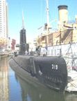
A Balao-class submarine that fought in World War II .
61
USS OLYMPIA
USS OLYMPIA More images
January 29, 1964(#66000692 )
Center City 39°56′36″N 75°08′27″W / 39.9433°N 75.1408°W / 39.9433; -75.1408 (USS OLYMPIA ) Penn's Landing
A naval cruiser that served as Commodore George Dewey 's flagship in the Battle of Manila Bay in 1898, during the Spanish–American War .
62
Wagner Free Institute of Science
Wagner Free Institute of Science More images
December 14, 1990(#89000361 )
North Philadelphia 39°58′50″N 75°09′46″W / 39.9806°N 75.1628°W / 39.9806; -75.1628 (Wagner Free Institute of Science) North Central
Founded by William Wagner . Dr. Joseph Leidy has some association, also.
63
Walnut Street Theatre
Walnut Street Theatre More images
December 29, 1962(#66000693 )
Center City 39°56′54″N 75°09′20″W / 39.9483°N 75.1556°W / 39.9483; -75.1556 (Walnut Street Theatre) Washington Square West
The oldest continuously operating theatre in the English-speaking world and the oldest in the United States. Maude Adams , Sarah Bernhardt , John Drew , Sir Henry Irving , Richard Mansfield , and Ellen Terry performed here.
64
John Wanamaker Store
John Wanamaker Store More images
June 2, 1978(#78002459 )
Center City 39°57′07″N 75°09′44″W / 39.9519°N 75.1622°W / 39.9519; -75.1622 (John Wanamaker Store) Market East
One of the first department stores in the United States.
65
Woodford
Woodford More images
December 24, 1967(#67000021 )
North Philadelphia 39°59′33″N 75°11′18″W / 39.9925°N 75.1883°W / 39.9925; -75.1883 (Woodford) Fairmount Park
A home of William Coleman .
66
The Woodlands
The Woodlands More images
December 24, 1967(#67000022 )
West Philadelphia 39°56′50″N 75°12′10″W / 39.9472°N 75.2028°W / 39.9472; -75.2028 (The Woodlands) University City
Colonial mansion and later a rural cemetery .
67
Wyck
Wyck More images
December 14, 1990(#71000736 )
Northwest Philadelphia 40°02′24″N 75°10′43″W / 40.04°N 75.178611°W / 40.04; -75.178611 (Wyck) Germantown
Historic house, begun in 1690, the oldest in Germantown, the site of a British field hospital in the Battle of Germantown .


