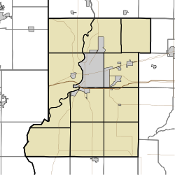
Place in Indiana, United States
| Lewis, Indiana | |
|---|---|
| Unincorporated community Census designated place | |
 | |
| Coordinates: 39°15′36″N 87°15′27″W / 39.26000°N 87.25750°W / 39.26000; -87.25750 | |
| Country | United States |
| State | Indiana |
| County | Vigo, Sullivan |
| Township | Pierson, Jackson |
| Platted | 9 September 1838 |
| Elevation | 610 ft (190 m) |
| Time zone | UTC-5 (Eastern) |
| • Summer (DST) | UTC-4 (EDT) |
| ZIP code | 47858 |
| Area code(s) | 812, 930 |
| FIPS code | 18-43020 |
| GNIS feature ID | 437800 |
Lewis, also known as Lewisburg or Centerville, is an unincorporated community and census designated place (CDP) in Vigo County, in the U.S. state of Indiana. Originally platted entirely within Vigo County, it has now expanded into adjacent Sullivan County.
It is part of the Terre Haute Metropolitan Statistical Area.
History
The town was laid out September 9, 1838, by Addison Williams near the south line of Vigo County, on the Centerville wagon road, which was used by the pony express for a few years. The first business in town was a tannery established by Joseph Stutman, and the first house was built by Charles Stewart in 1842. A cabinet shop run by the Buskirks and John B. Smith's blacksmith shop soon followed. Dodson & Jenkins opened a store in 1844. Lewis had a log school-house for many years, and established itself as a canal town as well.
The post office at Lewis has been in operation since 1840.
Geography
Lewis is located at 39°15′36″N 87°15′27″W / 39.26000°N 87.25750°W / 39.26000; -87.25750.
Demographics
The United States Census Bureau delineated Lewis as a census designated place in the 2022 American Community Survey.
References
- "US Board on Geographic Names". US Geological Survey. October 25, 2007. Retrieved July 14, 2016.
- "US Census website". US Census Bureau. Retrieved January 31, 2008.
- "Lewis, Indiana". Geographic Names Information System. US Geological Survey. Retrieved August 5, 2017.
- Bradsby, Henry C. (1891). History of Vigo County, Indiana, with Biographical Selections. Chicago: S. B. Nelson & Co. p. 476. Retrieved November 4, 2020.
- "Vigo County". Jim Forte Postal History. Retrieved July 14, 2016.
- "2022 Geography Changes". United States Census Bureau.
| Municipalities and communities of Sullivan County, Indiana, United States | ||
|---|---|---|
| County seat: Sullivan | ||
| Cities | ||
| Towns | ||
| Townships | ||
| CDPs | ||
| Other communities | ||
| Ghost towns | ||
| Footnotes | ‡This populated place also has portions in an adjacent county or counties | |
| Municipalities and communities of Vigo County, Indiana, United States | ||
|---|---|---|
| County seat: Terre Haute | ||
| City | ||
| Towns | ||
| Townships | ||
| CDPs | ||
| Other communities |
| |
| Footnotes | ‡This populated place also has portions in an adjacent county or counties | |
This Sullivan County, Indiana location article is a stub. You can help Misplaced Pages by expanding it. |
This Vigo County, Indiana location article is a stub. You can help Misplaced Pages by expanding it. |

