Airport
| Kroonstad Airport | |||||||||||||||||||
|---|---|---|---|---|---|---|---|---|---|---|---|---|---|---|---|---|---|---|---|
| Summary | |||||||||||||||||||
| Airport type | Public | ||||||||||||||||||
| Serves | Kroonstad, Free State, South Africa | ||||||||||||||||||
| Elevation AMSL | 4,700 ft / 1,433 m | ||||||||||||||||||
| Coordinates | 27°39′38″S 27°18′56″E / 27.66056°S 27.31556°E / -27.66056; 27.31556 | ||||||||||||||||||
| Map | |||||||||||||||||||
  | |||||||||||||||||||
| Runways | |||||||||||||||||||
| |||||||||||||||||||
| Sources: South African AIP, DAFIF | |||||||||||||||||||
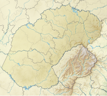
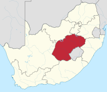
Kroonstad Airport (ICAO: FAKS) is an airport serving Kroonstad in the Free State province of South Africa.
Facilities
The airport resides at an elevation of 4,700 feet (1,433 m) above mean sea level. It has one asphalt paved runway designated 07/25 which measures 1,775 by 14 metres (5,823 ft × 46 ft); it also has two grass runways: 12/30 is 1,200 by 30 metres (3,937 ft × 98 ft) and 03/21 is 900 by 30 metres (2,953 ft × 98 ft).
See also
References
- ^ Airport information for FAKS from DAFIF (effective October 2006)
- ^ Airport information for FAKS at Great Circle Mapper. Source: DAFIF (effective October 2006).
External links
- Aeronautical chart and airport information for FAKS at SkyVector
- Accident history for FAKS at Aviation Safety Network
- FAKS on FlightStats
| Passenger airports of South Africa | |
|---|---|
| International | |
| Domestic | |
| Unscheduled | |
| Closed | |
| Statistics | |