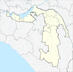
| Kozopolyansky
Козополянский Козополяновскэр | |
|---|---|
| Khutor | |
  | |
| Coordinates: 44°45′N 40°21′E / 44.750°N 40.350°E / 44.750; 40.350 | |
| Country | Russia |
| Region | Adygea |
| District | Giaginsky District |
| Time zone | UTC+3:00 |
Kozopolyansky (Russian: Козополянский; Adyghe: Козополяновскэр) is a rural locality (a khutor) in Sergiyevskoye Rural Settlement of Giaginsky District, Adygea, Russia. The population was 76 as of 2018. There are 2 streets.
Geography
The khutor is located on the left bank of the Fars River, 41 km southeast of Giaginskaya (the district's administrative centre) by road. Yekaterinovsky is the nearest rural locality.
Ethnicity
The khutor is inhabited by Russians.
References
- Карта хутора Козополянский в республике Адыгея
- "Численность постоянного населения по МО и населенным пунктам Республики Адыгея по состоянию на 1 января 2018 года". Archived from the original on 2018-08-01. Retrieved 2018-09-05.
- Расстояние от Козополянского до Гиагинской
This Adygea location article is a stub. You can help Misplaced Pages by expanding it. |