| Kozlovice | |
|---|---|
| Municipality | |
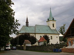
 Church of Saint Michael Church of Saint Michael | |
 Coat of arms Coat of arms | |
 | |
| Coordinates: 49°35′25″N 18°15′24″E / 49.59028°N 18.25667°E / 49.59028; 18.25667 | |
| Country | |
| Region | Moravian-Silesian |
| District | Frýdek-Místek |
| First mentioned | 1294 |
| Area | |
| • Total | 21.10 km (8.15 sq mi) |
| Elevation | 369 m (1,211 ft) |
| Population | |
| • Total | 3,112 |
| • Density | 150/km (380/sq mi) |
| Time zone | UTC+1 (CET) |
| • Summer (DST) | UTC+2 (CEST) |
| Postal code | 739 47 |
| Website | www |
Kozlovice (German: Potzmannsdorf) is a municipality and village in Frýdek-Místek District in the Moravian-Silesian Region of the Czech Republic. It has about 3,100 inhabitants.
Administrative division
Kozlovice consists of two municipal parts (in brackets population according to the 2021 census):
- Kozlovice (2,761)
- Měrkovice (224)
Geography
Kozlovice is located about 11 kilometres (7 mi) southwest of Frýdek-Místek and 23 km (14 mi) south of Ostrava. It lies in the Moravian-Silesian Foothills. The highest point is at 906 m (2,972 ft) above sea level. The Ondřejnice River flows through the municipality.
History
The first written mention of Kozlovice is from 1294. The village of Měrkovice was founded in 1789.
Demographics
|
|
| ||||||||||||||||||||||||||||||||||||||||||||||||||||||
| Source: Censuses | ||||||||||||||||||||||||||||||||||||||||||||||||||||||||
Transport

There are no railways or major roads passing through the municipality.
Sights
The main landmark of Kozlovice is the Church of Saints Barbara and Michael the Archangel. It was built in the Baroque style in 1731–1733. Around 1851, it was modified to its present form.
References
- "Population of Municipalities – 1 January 2024". Czech Statistical Office. 2024-05-17.
- "Public Census 2021 – basic data". Public Database (in Czech). Czech Statistical Office. 2022.
- "Historie obce" (in Czech). Obec Kozlovice. Retrieved 2022-02-24.
- "Historický lexikon obcí České republiky 1869–2011" (in Czech). Czech Statistical Office. 2015-12-21.
- "Population Census 2021: Population by sex". Public Database. Czech Statistical Office. 2021-03-27.
- "Kostel sv. Barbory a sv. Archanděla Michaela" (in Czech). National Heritage Institute. Retrieved 2024-03-26.