| Hunter's Tor | |
|---|---|
 Hunter's Tor, with Bovey Castle in the background Hunter's Tor, with Bovey Castle in the background | |
| Highest point | |
| Elevation | 320 m (1,050 ft) |
| Coordinates | 50°37′43″N 3°45′15″W / 50.628715°N 3.754030°W / 50.628715; -3.754030 |
| Geography | |
 | |
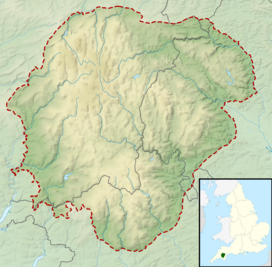
| Location | Dartmoor, England |
| OS grid | SX760825 |
| Topo map | OS Explorer OL28: Dartmoor |
Hunter's Tor is a granite tor located in the parish of Lustleigh, on Dartmoor. It is one of two tors with the same name, the other being in the Teign Gorge.
Location
Hunter's Tor is in the Lustleigh Cleave, on the apex of a ridge above the River Bovey. The tor is a natural viewpoint, and there is visibility to Haytor, Bowerman's Nose and Hamel Down.
Hill fort
The tor is the location for an Iron Age hill fort, probably due to the views and defensibility of the site. The hill fort was an oval enclosure which is 116 metres (381 ft) long and 70 metres (230 ft) wide, and it has three concentric ramparts with shallow ditches to the South East, and two to the North West.
Settlement
Main article: SutrewordeThere is some evidence that the land adjacent to the tor was settled after the Iron Age as the manor of Suðeswyrðe, later Sutreworde
Ghosts
There was a reported ghost sighting at Hunter's Tor in 1956, when two female riders cam across a mysterious group of a dozen mounted men in medieval costume with greyhounds. The women followed, but the men disappeared without a trace behind a stone wall, with no trace or hoofprints to indicate they were ever there.
There have also been reported ghosts of Roman legionnaires at the tor.
References
- ^ "Hunter's Tor (Lustleigh)". Tors of Dartmoor.
- Frere, SS (1977). Problems of the Iron Age in southern Britain : papers given at a C.B.A. conference held at the Institute of Archaeology, December 12 to 14, 1958. University of London Institute of Archaeology.
- Mortimer, Ian (December 2021). "The Location and Extent of King Alfred's Suðewyrðe". Reports and Transactions of the Devonshire Association for the advancement of Science. 153: 227–254.
- Bord, Janet (1991). Atlas of magical Britain. p. 19. ISBN 0283999853.
- "Dartmoor Myths & Legends". Visit Dartmoor.
This Devon location article is a stub. You can help Misplaced Pages by expanding it. |
This article about a specific United Kingdom geological feature is a stub. You can help Misplaced Pages by expanding it. |