Name
Location
Type
Completed Date designated
Grid ref. Entry number Image
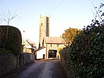
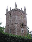
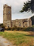
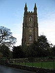
Church of St Andrew
Ashburton , TeignbridgeTower
before 1449
7 August 1951
SX7552669760 50°30′52″N 3°45′25″W / 50.514357°N 3.756997°W / 50.514357; -3.756997 (Church of St Andrew)
1201040 Church of St Andrew More images
Parish Church of St Nectan
Ashcombe , TeignbridgeParish Church
13th century
30 June 1961
SX9121879559 50°36′20″N 3°32′19″W / 50.605577°N 3.538627°W / 50.605577; -3.538627 (Parish Church of St Nectan)
1308702 Parish Church of St Nectan More images
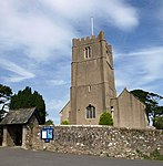
Church of St John the Baptist
Higher Ashton , Ashton , TeignbridgeParish Church
Early 15th century
30 June 1961
SX8561484684 50°39′02″N 3°37′10″W / 50.650574°N 3.61937°W / 50.650574; -3.61937 (Church of St John the Baptist)
1097856 Church of St John the Baptist More images
Church of St Mary the Virgin
Bickington , TeignbridgeChurch
late 19th century or early C20
23 August 1955
SX7997072679 50°32′29″N 3°41′43″W / 50.541525°N 3.695287°W / 50.541525; -3.695287 (Church of St Mary the Virgin)
1097150 Church of St Mary the Virgin More images
Church of St John the Baptist
Bishopsteignton , TeignbridgeParish Church
12th century
23 August 1955
SX9109773502 50°33′04″N 3°32′19″W / 50.551104°N 3.538561°W / 50.551104; -3.538561 (Church of St John the Baptist)
1147247 Church of St John the Baptist More images
Church of St Peter and St Paul and St Thomas of Canterbury
Bovey Tracey , TeignbridgeTower
14th century
23 August 1955
SX8207278611 50°35′43″N 3°40′03″W / 50.595276°N 3.667518°W / 50.595276; -3.667518 (Church of St Peter and St Paul and St Thomas of Canterbury)
1334077 Church of St Peter and St Paul and St Thomas of Canterbury More images
Bridford Barton
Bridford , TeignbridgeFarmhouse
Circa early-mid 14th century
9 March 1988
SX8162286423 50°39′55″N 3°40′35″W / 50.665407°N 3.676369°W / 50.665407; -3.676369 (Bridford Barton)
1318200 Bridford Barton More images
Church of St Thomas a Becket
Bridford , TeignbridgeGate
19th century
30 June 1961
SX8160186381 50°39′54″N 3°40′36″W / 50.665025°N 3.676653°W / 50.665025; -3.676653 (Church of St Thomas a Becket)
1097825 Church of St Thomas a Becket More images
Church of St Peter and St Paul
Broadhempston , TeignbridgeParish Church
13th century
17 July 1987
SX8011866276 50°29′02″N 3°41′28″W / 50.483998°N 3.691141°W / 50.483998; -3.691141 (Church of St Peter and St Paul)
1317828 Church of St Peter and St Paul More images
Canonteign Barton
Christow , TeignbridgeManor House
Circa late 16th century
11 November 1952
SX8379183124 50°38′10″N 3°38′41″W / 50.636189°N 3.644656°W / 50.636189; -3.644656 (Canonteign Barton)
1097834 Canonteign Barton More images
Church of Saint James the Apostle
Christow , TeignbridgeParish Church
15th century
30 June 1961
SX8361385039 50°39′12″N 3°38′52″W / 50.653368°N 3.647774°W / 50.653368; -3.647774 (Church of Saint James the Apostle)
1163790 Church of Saint James the Apostle More images
Hill
Christow , TeignbridgeFarmhouse
Former
9 October 1980
SX8353184246 50°38′46″N 3°38′55″W / 50.646223°N 3.648684°W / 50.646223; -3.648684 (Hill)
1097796 Hill More images
Church of St Mary and St Martin
Chudleigh , TeignbridgeChurch
At least 1225
23 August 1955
SX8671479407 50°36′12″N 3°36′08″W / 50.603352°N 3.602204°W / 50.603352; -3.602204 (Church of St Mary and St Martin)
1164590 Church of St Mary and St Martin More images
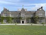
Ugbrooke Park
Chudleigh , TeignbridgeCountry House
Late 16th century
23 August 1955
SX8756978053 50°35′29″N 3°35′23″W / 50.591346°N 3.589716°W / 50.591346; -3.589716 (Ugbrooke Park)
1097135 Ugbrooke Park More images
Church of St Barthelomew
Coffinswell , TeignbridgeParish Church
Probably 13th century
23 August 1955
SX8912068430 50°30′18″N 3°33′54″W / 50.505136°N 3.564946°W / 50.505136; -3.564946 (Church of St Barthelomew)
1164557 Church of St Barthelomew More images
Chapel of St Alban, Luscombe Castle , Including Attached Stables and Other Outbuildings
Dawlish , TeignbridgeCastle
1800
17 July 1951
SX9429576811 50°34′53″N 3°29′40″W / 50.581439°N 3.494377°W / 50.581439; -3.494377 (Chapel of St Alban, Luscombe Castle, Including Attached Stables and Other Outbuildings)
1164298 Chapel of St Alban, Luscombe Castle , Including Attached Stables and Other Outbuildings More images
Church of St Mary the Virgin
Denbury , Denbury and Torbryan , TeignbridgeParish Church
Early 14th century
15 October 1984
SX8237668853 50°30′27″N 3°39′37″W / 50.507622°N 3.66014°W / 50.507622; -3.66014 (Church of St Mary the Virgin)
1170197 Church of St Mary the Virgin More images
Church of the Holy Trinity
Torbryan Hamlet, Denbury and Torbryan, TeignbridgeParish Church
Early 15th century
23 August 1955
SX8198466832 50°29′22″N 3°39′54″W / 50.489376°N 3.665026°W / 50.489376; -3.665026 (Church of the Holy Trinity)
1249658 Church of the Holy Trinity More images
Church of St Michael
Doddiscombsleigh , TeignbridgeParish Church
15th century
30 June 1961
SX8575786556 50°40′03″N 3°37′05″W / 50.667429°N 3.617927°W / 50.667429; -3.617927 (Church of St Michael)
1333908 Church of St Michael More images
Church of St Michael
Dunchideock , TeignbridgeParish Church
13th century
30 June 1961
SX8761287675 50°40′40″N 3°35′31″W / 50.67785°N 3.592029°W / 50.67785; -3.592029 (Church of St Michael)
1334285 Church of St Michael More images
Church of St Mary
Dunsford , TeignbridgeChurch
early 19th century or earlier
30 June 1961
SX8130389204 50°41′25″N 3°40′54″W / 50.69034°N 3.681774°W / 50.69034; -3.681774 (Church of St Mary)
1215069 Church of St Mary More images
Great Fulford House
Dunsford , TeignbridgeKitchen
16th century
11 November 1952
SX7907291710 50°42′45″N 3°42′51″W / 50.712406°N 3.714165°W / 50.712406; -3.714165 (Great Fulford House)
1214302 Great Fulford HouseMore images
Church of St Martin
Exminster , TeignbridgeParish Church
Late 14th century
30 June 1961
SX9455787708 50°40′46″N 3°29′38″W / 50.679448°N 3.49378°W / 50.679448; -3.49378 (Church of St Martin)
1334270 Church of St Martin More images
Church of St Blaise
Haccombe , Haccombe with Combe , TeignbridgeCollegiate Church
13th century
23 August 1955
SX8980670198 50°31′16″N 3°33′21″W / 50.52116°N 3.555799°W / 50.52116; -3.555799 (Church of St Blaise)
1168193 Church of St Blaise More images
Church of St Mary
Hennock , TeignbridgeParish Church
15th century
23 August 1955
SX8301680923 50°36′58″N 3°39′18″W / 50.616249°N 3.654915°W / 50.616249; -3.654915 (Church of St Mary)
1166001 Church of St Mary More images
Church of St Michael
Ilsington , TeignbridgeParish Church
Late 13th century or early 14th century
23 August 1955
SX7853476144 50°34′21″N 3°43′00″W / 50.572375°N 3.716674°W / 50.572375; -3.716674 (Church of St Michael)
1240794 Church of St Michael More images
Church of St Andrew
Ipplepen , TeignbridgeChurch
1713
23 August 1955
SX8340866554 50°29′14″N 3°38′42″W / 50.487162°N 3.644874°W / 50.487162; -3.644874 (Church of St Andrew)
1334135 Church of St Andrew More images
Church of St Andrew
Kenn , TeignbridgeParish Church
Early 14th century
30 June 1961
SX9219785696 50°39′39″N 3°31′36″W / 50.660928°N 3.526584°W / 50.660928; -3.526584 (Church of St Andrew)
1097721 Church of St Andrew More images
Church of All Saints
Kenton , TeignbridgeParish Church
Circa 1360-70
30 June 1961
SX9579783311 50°38′25″N 3°28′30″W / 50.640143°N 3.474997°W / 50.640143; -3.474997 (Church of All Saints)
1169255 Church of All Saints More images
Church of St John the Baptist
Lustleigh , TeignbridgeParish Church
13th century
23 August 1955
SX7850081274 50°37′07″N 3°43′08″W / 50.61848°N 3.718833°W / 50.61848; -3.718833 (Church of St John the Baptist)
1334119 Church of St John the Baptist More images
Uphill, the Great Hall, and Oaknuve
Mapstone, Lustleigh, Teignbridge
Cruck House
Late medieval
23 August 1955
SX7824581652 50°37′19″N 3°43′21″W / 50.621825°N 3.72256°W / 50.621825; -3.72256 (Uphill, the Great Hall, and Oaknuve)
1334122 Upload Photo
Mamhead House
Mamhead , TeignbridgeCountry House
1827-1833
11 November 1952
SX9304081092 50°37′11″N 3°30′48″W / 50.619695°N 3.513331°W / 50.619695; -3.513331 (Mamhead House)
1170130 Mamhead House More images
Church of St Winifrid
Manaton , TeignbridgeParish Church
15th century
23 August 1955
SX7493581280 50°37′04″N 3°46′09″W / 50.61778°N 3.769203°W / 50.61778; -3.769203 (Church of St Winifrid)
1097224 Church of St Winifrid More images
Neadon Upper Hall
Manaton , TeignbridgeHouse
1982-1983
23 August 1955
SX7504982433 50°37′41″N 3°46′05″W / 50.628168°N 3.767982°W / 50.628168; -3.767982 (Neadon Upper Hall)
1097260 Upload Photo
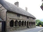
Almshouses
Moretonhampstead , TeignbridgeCruck House
Late Medieval
23 August 1955
SX7554586031 50°39′38″N 3°45′44″W / 50.660615°N 3.762182°W / 50.660615; -3.762182 (Almshouses)
1334200 Almshouses More images
Church of St Andrew
Moretonhampstead , TeignbridgeChurch
15th century
23 August 1955
SX7553286092 50°39′40″N 3°45′45″W / 50.661161°N 3.762387°W / 50.661161; -3.762387 (Church of St Andrew)
1334222 Church of St Andrew More images
Bradley Manor
Newton Abbot , TeignbridgeFirst Floor Hall House
Early 13th century
16 July 1949
SX8485070859 50°31′34″N 3°37′33″W / 50.526147°N 3.625885°W / 50.526147; -3.625885 (Bradley Manor)
1256765 Bradley Manor More images
Forde House
Newton Abbot, Teignbridge
Lobby Entry House
c. 1550
16 July 1949
SX8699670940 50°31′38″N 3°35′44″W / 50.527294°N 3.595647°W / 50.527294; -3.595647 (Forde House)
1256796 Forde House More images
Parish Church of All Saints
Highweek , Newton Abbot, TeignbridgeChapel of Ease
15th century
16 July 1949
SX8514572092 50°32′14″N 3°37′20″W / 50.537289°N 3.622105°W / 50.537289; -3.622105 (Parish Church of All Saints)
1257209 Parish Church of All Saints More images
Parish Church of St Mary the Virgin
Newton Abbot , TeignbridgeParish Church
Before 15th century
16 July 1949
SX8549270375 50°31′19″N 3°37′00″W / 50.521922°N 3.616683°W / 50.521922; -3.616683 (Parish Church of St Mary the Virgin)
1256897 Parish Church of St Mary the Virgin More images
Church of St John the Baptist
North Bovey , TeignbridgeParish Church
13th century
23 August 1955
SX7393583832 50°38′26″N 3°47′03″W / 50.640503°N 3.7842°W / 50.640503; -3.7842 (Church of St John the Baptist)
1097172 Church of St John the Baptist More images
Sanders
Lettaford, North Bovey, Teignbridge
Cross Passage House
Early 16th century
6 November 1972
SX7019184058 50°38′30″N 3°50′14″W / 50.641712°N 3.837199°W / 50.641712; -3.837199 (Sanders)
1307005 Sanders More images
Church of St Bartholomew
East Ogwell , Ogwell , TeignbridgeBoiler House
C20
23 August 1955
SX8381170054 50°31′07″N 3°38′25″W / 50.518705°N 3.640286°W / 50.518705; -3.640286 (Church of St Bartholomew)
1096697 Church of St Bartholomew More images
West Ogwell Church
West Ogwell , Ogwell, TeignbridgeParish Church
Late 13th century
23 August 1955
SX8186770046 50°31′06″N 3°40′04″W / 50.518243°N 3.667693°W / 50.518243; -3.667693 (West Ogwell Church)
1334475 West Ogwell Church More images
Powderham Castle
Powderham , TeignbridgeFortified Manor House
Medieval
11 November 1952
SX9682483604 50°38′35″N 3°27′38″W / 50.64296°N 3.46056°W / 50.64296; -3.46056 (Powderham Castle)
1097666 Powderham Castle More images
Church of St Peter
Shaldon , TeignbridgeChurch
1932
30 June 1949
SX9315272451 50°32′31″N 3°30′33″W / 50.542035°N 3.509263°W / 50.542035; -3.509263 (Church of St Peter)
1269235 Church of St Peter More images
The Starcross Pumping House
Starcross , TeignbridgeRailway Engine House
1845
11 November 1952
SX9774181752 50°37′35″N 3°26′50″W / 50.626473°N 3.447084°W / 50.626473; -3.447084 (The Starcross Pumping House)
1097684 The Starcross Pumping House More images
Church of St Catherine of Alexandria
Church Town, Whitestone , Teignbridge
Parish Church
Medieval
4 September 1986
SX8687294355 50°44′16″N 3°36′16″W / 50.737754°N 3.604547°W / 50.737754; -3.604547 (Church of St Catherine of Alexandria)
1216459 Church of St Catherine of Alexandria More images
Church of St Pancras
Widecombe in the Moor , TeignbridgeParish Church
15th century
23 August 1955
SX7187976791 50°34′36″N 3°48′39″W / 50.576767°N 3.810829°W / 50.576767; -3.810829 (Church of St Pancras)
1242571 Church of St Pancras More images
Higher Uppacott, Uppacott
Widecombe in the Moor, Teignbridge
House
Medieval
23 August 1955
SX7013172879 50°32′28″N 3°50′03″W / 50.541219°N 3.834137°W / 50.541219; -3.834137 (Higher Uppacott, Uppacott)
1241837 Higher Uppacott, Uppacott More images
Church of St John the Baptist
Woodland Hamlet, Woodland , Teignbridge
Parish Church
15th century
23 August 1955
SX7912868758 50°30′22″N 3°42′21″W / 50.506106°N 3.705892°W / 50.506106; -3.705892 (Church of St John the Baptist)
1263572 Church of St John the Baptist More images


