Name
Location
Type
Completed Date designated
Grid ref. Entry number Image
Meadow House
Cobham , Gravesham House
1770
21 November 1966
TQ6699068623 51°23′31″N 0°23′56″E / 51.392075°N 0.398786°E / 51.392075; 0.398786 (Meadow House)
1373849 Upload Photo
Owletts
Cobham House
1683/1684
27 August 1952
TQ6651068734 51°23′36″N 0°23′31″E / 51.393213°N 0.391945°E / 51.393213; 0.391945 (Owletts)
1049097 Owletts More images
The Dairy, Cobham Hall
Cobham
Dairy
c. 1790
22 June 1982
TQ6833668617 51°23′30″N 0°25′05″E / 51.391624°N 0.418111°E / 51.391624; 0.418111 (The Dairy, Cobham Hall)
1350898 Upload Photo
Parish Church of St Peter and St Paul
Luddesdown Parish Church
13th century
21 November 1966
TQ6695566177 51°22′12″N 0°23′50″E / 51.370111°N 0.397134°E / 51.370111; 0.397134 (Parish Church of St Peter and St Paul)
1096342 Parish Church of St Peter and St Paul More images
Church of St Mildred
Nurstead , Meopham Church
Perhaps earlier
21 November 1966
TQ6412368279 51°23′23″N 0°21′27″E / 51.38982°N 0.357457°E / 51.38982; 0.357457 (Church of St Mildred)
1096351 Church of St Mildred More images
Killick's Mill, Meopham
Meopham
Smock Mill
1801
22 August 1952
TQ6394765183 51°21′43″N 0°21′13″E / 51.362056°N 0.353502°E / 51.362056; 0.353502 (Killick's Mill, Meopham)
1054722 Killick's Mill, Meopham More images
Church of St Peter and St Paul
Shorne Church
12th century
21 November 1966
TQ6906171020 51°24′47″N 0°25′47″E / 51.412996°N 0.429665°E / 51.412996; 0.429665 (Church of St Peter and St Paul)
1083891 Church of St Peter and St Paul More images
Little St Katherine's
Shorne
House
19th century
27 August 1952
TQ6925171459 51°25′01″N 0°25′57″E / 51.416883°N 0.432604°E / 51.416883; 0.432604 (Little St Katherine's)
1083895 Little St Katherine's More images
Church of All Saints
Northfleet Parish Church
1869-70
30 July 1986
TQ6355273114 51°26′00″N 0°21′05″E / 51.433423°N 0.351486°E / 51.433423; 0.351486 (Church of All Saints)
1346415 Church of All Saints More images
Church of Our Lady of the Assumption
The Hill, Northfleet
Roman Catholic Church
1913-16
26 July 1983
TQ6247574089 51°26′33″N 0°20′11″E / 51.442492°N 0.336453°E / 51.442492; 0.336453 (Church of Our Lady of the Assumption)
1081094 Church of Our Lady of the Assumption More images
Church of St George
Gravesend Parish Church
1731-1732
23 January 1952
TQ6468974341 51°26′39″N 0°22′06″E / 51.444117°N 0.368398°E / 51.444117; 0.368398 (Church of St George)
1089034 Church of St George More images
Church of St Mary
Chalk Parish Church
Late C11/early 12th century
23 January 1952
TQ6832572498 51°25′35″N 0°25′11″E / 51.426492°N 0.419793°E / 51.426492; 0.419793 (Church of St Mary)
1089044 Church of St Mary More images
Church of St Peter and St Paul
Milton-next-Gravesend Parish Hall
1992
23 January 1952
TQ6589773831 51°26′21″N 0°23′08″E / 51.439183°N 0.385526°E / 51.439183; 0.385526 (Church of St Peter and St Paul)
1341484 Church of St Peter and St Paul More images
Ifield Court
Ifield Court, Northfleet
House
18th century
4 July 1952
TQ6478569957 51°24′17″N 0°22′04″E / 51.404704°N 0.367741°E / 51.404704; 0.367741 (Ifield Court)
1350208 Ifield Court More images
Milton Chantry
Milton-next-Gravesend
House
Reformation
23 January 1952
TQ6525474338 51°26′38″N 0°22′35″E / 51.443925°N 0.376519°E / 51.443925; 0.376519 (Milton Chantry)
1089047 Milton Chantry More images
New Tavern Fort
Gravesend Artillery Fort
Begun 1869
24 February 1977
TQ6529274238 51°26′35″N 0°22′37″E / 51.443016°N 0.377019°E / 51.443016; 0.377019 (New Tavern Fort)
1261173 New Tavern Fort More images
The Old Rectory House
Northfleet
House
After 1656
4 July 1952
TQ6233173419 51°26′11″N 0°20′03″E / 51.436514°N 0.334076°E / 51.436514; 0.334076 (The Old Rectory House)
1081093 Upload Photo
The Town Hall
Gravesend
Town Hall
1836
23 January 1952
TQ6477974271 51°26′36″N 0°22′11″E / 51.443462°N 0.369659°E / 51.443462; 0.369659 (The Town Hall)
1054761 The Town Hall More images
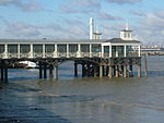
The Town Pier
Gravesend
Pier
1831-1834
3 July 1975
TQ6477474480 51°26′43″N 0°22′11″E / 51.445341°N 0.369685°E / 51.445341; 0.369685 (The Town Pier)
1089004 The Town Pier More images
80 High Street
Gravesend
House
Early to mid 18th century
19 March 1974
TQ6475774398 51°26′41″N 0°22′10″E / 51.444609°N 0.369402°E / 51.444609; 0.369402 (80 High Street)
1367090 Upload Photo

