| Fjotland | |
|---|---|
| Village | |
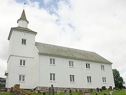
 View of the village church View of the village church | |
  | |
| Coordinates: 58°31′35″N 06°59′31″E / 58.52639°N 6.99194°E / 58.52639; 6.99194 | |
| Country | Norway |
| Region | Southern Norway |
| County | Agder |
| District | Lister |
| Municipality | Kvinesdal |
| Elevation | 333 m (1,093 ft) |
| Time zone | UTC+01:00 (CET) |
| • Summer (DST) | UTC+02:00 (CEST) |
| Post Code | 4480 Kvinesdal |
Fjotland is a village in Kvinesdal municipality in Agder county, Norway. The village is located in the northern part of the Kvinesdalen valley on the northeast side of the lake Fjotlandsvatnet. Fjotland is about 17 kilometres (11 mi) southeast of the village of Haughom in Sirdal and about 25 kilometres (16 mi) north of Liknes. Fjotland was the administrative centre of the old municipality of Fjotland which existed prior to 1963. Fjotland Church is located in the village.
Name
The name of the municipality (originally the parish) comes from the old Fjotland farm (Old Norse: Fjósaland). The first element in the name comes from the word fjøs which means "barn" and the last element in the name comes from the word land which means "land".
References
- "Fjotland, Kvinesdal (Vest-Agder)". yr.no. Retrieved 14 September 2016.
- Rygh, Oluf (1912). Norske gaardnavne: Lister og Mandals amt (in Norwegian) (9 ed.). Kristiania, Norge: W. C. Fabritius & sønners bogtrikkeri. p. 276.
External links
- Weather information for Fjotland (in Norwegian)