| Ellen Street Western Australia | |
|---|---|
 | |
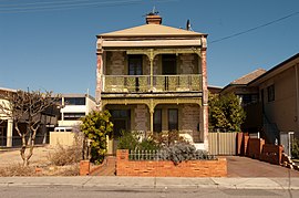
| 37 Ellen St, a heritage place | |
| General information | |
| Type | Road |
| Length | 850 m (0.5 mi) |
| Major junctions | |
| West end |
|
| |
| East end |
|
| Location(s) | |
| Major suburbs | Fremantle |
Ellen Street is a parallel road to High Street in Fremantle, Western Australia. It was named after Ellen Stirling (née Mangles), wife of Governor Stirling.
It has a range of heritage listed properties on its southern side including Christian Brothers College and Samson House, and on the northern side has the Fremantle Bowling Club at the intersection with Parry Street, Fremantle Park, and John Curtin College of the Arts.
Intersections
| LGA | Location | km | mi | Destinations | Notes |
|---|---|---|---|---|---|
| Fremantle | Fremantle | 0 | 0.0 | Point Street / Josephson Street | Give way sign controlled T-junction, giving Point Street/Ellen Street priority; Ellen Street is one-way eastbound east of intersection; Ellen Street continues west as Point Street |
| 0.13 | 0.081 | Parry Street | Stop sign controlled intersection, giving Parry Street priority; Ellen Street is two-way east of intersection | ||
| 0.4 | 0.25 | Stirling Street | T-junction | ||
| 0.5 | 0.31 | Stop sign controlled intersection, giving Ord Street priority; Ellen Street eastbound must turn left onto Ord Street northbound; no right turn from Ord Street northbound to Ellen Street eastbound or Ellen Street westbound to Ord Street northbound | |||
| 0.6 | 0.37 | Girton Lane | Left-in/left-out; connects to one-way westbound frontage road | ||
| 0.65 | 0.40 | Girton Lane | Left-in/left-out; connects to one-way westbound frontage road | ||
| 0.75 | 0.47 | Loukes Street | Left-in/left-out; connects to one-way westbound frontage road | ||
| 0.85 | 0.53 | Holland Street / East Street | Stop sign controlled intersection, giving East Street priority; Ellen Street continues east as Holland Street | ||
| 1.000 mi = 1.609 km; 1.000 km = 0.621 mi | |||||
See also
Notes
- ^ "Ellen Street". Google Maps. Retrieved 1 December 2022.
- "Stirling, Lady Ellen (1807–1874)". Retrieved 13 November 2012.
- Ewers, John K. (1971). The Western Gateway: A History of Fremantle (2nd ed.). Nedlands, Western Australia: University of Western Australia Press for the Fremantle City Council. p. 222. ISBN 085564 050 2.
- "FREMANTLE C.B.C. OLD BOYS". The West Australian. Perth: National Library of Australia. 27 March 1936. p. 11. Retrieved 24 December 2013.
- Building Management Authority of Western Australia; Western Australian Museum (1995), Samson House cottage and 'stables', Ellen Street, Fremantle : conservation plan for the Western Australian Museum, Building Management Authority, retrieved 8 November 2012
- Orloff, Izzy; HRRC (1928), Fremantle Bowling Club opening, retrieved 8 November 2012
| Streets of Fremantle, Western Australia, Australia | ||||||
|---|---|---|---|---|---|---|
| Fremantle city centre |
| |||||
| Greater Fremantle | ||||||
This Western Australian road or road transport-related article is a stub. You can help Misplaced Pages by expanding it. |
This Fremantle-related article is a stub. You can help Misplaced Pages by expanding it. |