| Elephants Back | |
|---|---|
 North aspect North aspect | |
| Highest point | |
| Elevation | 9,585 ft (2,922 m) |
| Prominence | 465 ft (142 m) |
| Parent peak | Round Top (10,381ft) |
| Isolation | 1.43 mi (2.30 km) |
| Coordinates | 38°40′42″N 119°58′59″W / 38.6784131°N 119.9831181°W / 38.6784131; -119.9831181 |
| Geography | |
  | |
| Location | Mokelumne Wilderness |
| Country | United States of America |
| State | California |
| County | Alpine |
| Parent range | Sierra Nevada |
| Topo map | USGS Carson Pass |
| Geology | |
| Rock age | Miocene |
| Mountain type | Lava dome |
| Rock type | andesitic |
| Climbing | |
| First ascent | 1844 |
| Easiest route | class 1 hiking |
Elephants Back is a 9,585-foot-elevation (2,922 meter) mountain summit located in Alpine County, California, United States.
Description
This landmark of Hope Valley is set in the Mokelumne Wilderness of the Sierra Nevada mountain range. The summit is situated one mile south of Carson Pass and 1.4 miles (2.3 km) northeast of line parent Round Top. Elephants Back is a lava dome which was created in association with the now-inactive volcanic vent that is Round Top. Precipitation runoff from the peak's east slope drains to the West Fork Carson River via Red Lake Creek, whereas the west slope drains to Caples Lake via Woods Creek. Topographic relief is significant as the summit rises 1,600 feet (490 meters) above Forestdale Creek in less than one mile. The Pacific Crest Trail traverses the eastern and northern slopes of this peak, providing an approach from California State Route 88.
History

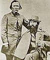
During his second exploratory expedition, John C. Frémont camped at the base of Elephants Back's north ridge on February 9, 1844. At this spot, the party burned two trees to protect themselves from icy winds of a fierce winter storm. Frémont and Kit Carson made the first known ascent of Elephants Back three days earlier, on February 6, 1844, and were able to see the Sacramento Valley from the summit.
The United States Geological Survey surveyed this area in 1889 and labelled this geographic feature on their 1893 Markleeville quadrangle map. This landform is so named because of its resemblance to the animal. This landform's toponym has been officially adopted by the U.S. Board on Geographic Names. It has also been called "Elephant Mountain", "Elephant's Back", and "The Elephant."
Climate
According to the Köppen climate classification system, Elephants Back is located in an alpine climate zone. Most weather fronts originate in the Pacific Ocean and travel east toward the Sierra Nevada mountains. As fronts approach, they are forced upward by the peaks (orographic lift), causing them to drop their moisture in the form of rain or snowfall onto the range.
Geology
Elephants Back is an andesitic lava dome, a type of volcano. Due to its position, it could be a flank vent of Round Top (Alpine County, California).
Gallery
-
 Winter scene from slopes of Red Lake Peak at Carson Pass with Elephants Back centered at top
-
 West aspect of Elephants Back from the trail to Winnemucca Lake.
-
 Southwest aspect of Elephants Back, with Winnemucca Lake
-
 Elephants Back (left) and Round Top (right)
-
 North aspect of Elephants Back rises above Carson Pass
-
 Winnemucca Lake, Elephants Back, and Hope Valley seen from Round Top
-
 Elephants Back (left) and Round Top (right) seen from Hope Valley.
-
 East aspect
-
 Caples Lake with Elephants Back to left and Round Top centered.
-
 Elephants Back to left
See also
References
- United States Geological Survey topographical map - Carson Pass
- Peter Browning, Place Names of the Sierra Nevada: From Abbot to Zumwalt, 1986, Wilderness Press, ISBN 9780899970479, p. 64.
- ^ "Elephants Back, California". Peakbagger.com. Retrieved July 1, 2022.
- ^ "Elephants Back - 9,585' CA". listsofjohn.com. Retrieved July 1, 2022.
- ^ "Elephants Back". Geographic Names Information System. United States Geological Survey, United States Department of the Interior. Retrieved July 1, 2022.
- Matt Johanson (2019), Sierra Summits: A Guide to Fifty Peak Experiences in California's Range of Light, Falcon Guides, ISBN 9781493036455, p. 45
- Ferol Egan (2012), Fremont: Explorer for a Restless Nation, University of Nevada Press, ISBN 9780874178982
- Tom Chaffin (2014), Pathfinder: John Charles Frémont and the Course of American Empire, University of Oklahoma Press, ISBN 9780806146072
- Erwin Gustav Gudde (1960), California Place Names, University of California Press, p. 100
- "Climate of the Sierra Nevada". Encyclopædia Britannica.
External links
- Weather forecast: Elephants Back