| El Escondido | |
|---|---|
| Volcán El Escondido | |
 | |
| Highest point | |
| Elevation | 1,700 m (5,600 ft) |
| Listing | Volcanoes of Colombia |
| Coordinates | 05°31′10.1″N 75°02′36.5″W / 5.519472°N 75.043472°W / 5.519472; -75.043472 |
| Geography | |
| Location | Samaná, Caldas |
| Parent range | Central Ranges, Andes |
| Geology | |
| Rock age | Late Pleistocene (<30,000 years) |
| Mountain type | Pyroclastic ring |
| Volcanic belt | North Volcanic Zone Andean Volcanic Belt |
| Last eruption | Prehistoric |
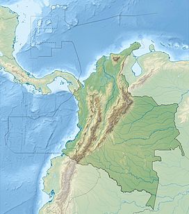
El Escondido (Spanish for "The Hidden One") is a volcano of the Central Ranges of the Colombian Andes in the department of Caldas. The volcano is approximately 1,700 metres (5,600 ft) high.
The volcano, a pyroclastic ring, was discovered in the Selva de Florencia National Natural Park in Samaná, in 2013 based on volcanic products of the volcano, different from those of San Diego to the northeast. The volcano formed approximately 30,000 years ago. The volcano overlies the Early Eocene Florencia Stock.
See also
References
- Ortiz Ángel, 2015
- Monsalve, 2015
- (in Spanish) Geólogos encontraron nuevo volcán en Caldas - El País
- Mapa Geológico de Caldas, 1999
Bibliography
- Ortiz Ángel, Sandra Victoria (2015), El Servicio Geológico Colombiano descubre volcán en el oriente de Caldas (PDF), Servicio Geológico Colombiano, p. 1, retrieved 2017-09-24
- Monsalve, María Luisa (2015), Entrevista a la geóloga María Luisa Monsalve sobre el volcán El Escondido, La Patria, pp. 03:25, retrieved 2017-09-24
Maps
- Gómez, J.; Montes, N.E.; Nivia, Á.; Diederix, H. (2015), Plancha 5-09 del Atlas Geológico de Colombia 2015 – escala 1:500,000, Servicio Geológico Colombiano, p. 1, retrieved 2017-09-24
- González I., Humberto (1990), Mapa Geológico de Caldas 1:250,000, INGEOMINAS, p. 1, retrieved 2017-09-21
| Volcanoes of Colombia | ||
|---|---|---|
| Western Ranges |  | |
| Central Ranges | ||
| Eastern Ranges | ||
| Other | ||
| Source | ||