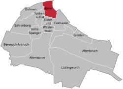
| Döse | |
|---|---|
| Stadtteil of Cuxhaven | |
Döse in Cuxhaven
 | |
  | |
| Coordinates: 53°52′58″N 08°40′22″E / 53.88278°N 8.67278°E / 53.88278; 8.67278 | |
| Country | Germany |
| State | Lower Saxony |
| District | Cuxhaven |
| Town | Cuxhaven |
| Elevation | 2 m (7 ft) |
| Population | |
| • Total | 12,773 |
| Time zone | UTC+01:00 (CET) |
| • Summer (DST) | UTC+02:00 (CEST) |
| Postal codes | 27476 |
| Dialling codes | 04721 |
| Website | www |
Döse (Low German: Döös) the northernmost town in Lower Saxony, Germany at the point where the River Elbe flows into the North Sea. It is a borough of the city Cuxhaven and a popular seaside resort. Döse is located west of Grimmershörn in the borough of Cuxhaven and is one of the tourist centres of the region of Cuxland.
History
Until 1937 Döse, like Cuxhaven, was part of the Land of Hamburg.
| Year | Pop. | ±% |
|---|---|---|
| 1826 | 510 | — |
| 1847 | 539 | +5.7% |
| 1905 | 2,230 | +313.7% |
| 2006 | 12,773 | +472.8% |
Gallery
-
 The Evangelical Lutheran "Döser Kirche": Döse Church of St. Gertrud's
-
 Beach at Döse
-
 The Kugelbake, marking the northernmost point of Lower Saxony
References
- Neue allgemeine geographische und statistische Ephemeriden, Band 19. 1826, p. 368
- Franz Heinrich Neddermeyer: Zur Statistik und Topographie der Freien und Hansestadt Hamburg und deren Gebietes. 1847, p. 190
This Cuxhaven district location article is a stub. You can help Misplaced Pages by expanding it. |