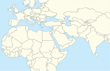
| Buraimi Airport مطار البريمي | |||||||||||
|---|---|---|---|---|---|---|---|---|---|---|---|
| Summary | |||||||||||
| Airport type | Public | ||||||||||
| Serves | Buraimi, Oman | ||||||||||
| Elevation AMSL | 970 ft / 296 m | ||||||||||
| Coordinates | 24°14′30″N 55°47′00″E / 24.24167°N 55.78333°E / 24.24167; 55.78333 | ||||||||||
| Map | |||||||||||
    | |||||||||||
| Runways | |||||||||||
| |||||||||||
| Source: GCM Google Maps | |||||||||||
Buraimi Airport (Arabic: مطار البريمي, romanized: Maṭār Al-Buraymī; (IATA: RMB, ICAO: OOBR)) is an airport serving the town of Al-Buraimi in Oman.
Al Ain International Airport (VOR-DME (Ident: ALN) and non-directional beacon (Ident: AIN)) are located 9.8 nautical miles (18 km) west of this airport.
See also
References
- Airport information for RMB at Great Circle Mapper.
- Google Maps - Buraimi
- "Al Ain VOR". Our Airports. Retrieved 13 January 2019.
- "Al Ain NDB". Our Airports. Retrieved 13 January 2019.
External links
- OurAirports - Oman
- OpenStreetMap - Buraimi
- Buraimi
- Accident history for OOBR at Aviation Safety Network
| Airports in Oman | |
|---|---|
| Major international | |
| Minor international | |
| Domestic | |
| Unscheduled | |
This article about the geography of Oman is a stub. You can help Misplaced Pages by expanding it. |