Historic site in Gloucestershire, England
| Boxwell Court | |
|---|---|
 Boxwell Court photographed from the Monarch's Way Boxwell Court photographed from the Monarch's Way | |
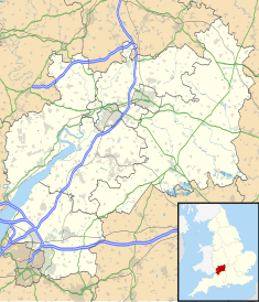
| Location | Leighterton, Gloucestershire, England |
| Coordinates | 51°37′58.5″N 02°16′22″W / 51.632917°N 2.27278°W / 51.632917; -2.27278 |
 | |
Boxwell Court is a country house near Leighterton in Gloucestershire, England, about 5 km or 3 miles east of Wotton-under-Edge, dating from the 15th and 16th centuries. It is a Grade II* listed building.
History
The house is thought to be the site of a former monastery, associated with Gloucester Abbey. Nothing remains of the monastery or nunnery except a holy well.
The estate was given to the Huntley family following Henry VIII's dissolution of the monasteries. The House has been in the Huntley family continuously since that time; it is believed that the family have lived on the site for 600 years. The estate is approximately 1,000 acres (4.0 km), which although large in today's terms, is small compared to the size of the Huntleys' former Gloucestershire estates which included Woodchester and Frocester. The estate is known for its box wood, which used to provide a very large income to the Huntleys.
The house has been frequented by royalty; Prince Rupert stayed in the house on several occasions. There is a story that King Charles II, when fleeing from the Battle of Worcester, stayed on the estate and, in gratitude to the family, gave them his ring which remains in the family's possession. The Monarch's Way which runs past the house is a 625-mile (1,006 km) long-distance footpath that approximates the escape route taken by King Charles II in 1651.
Architecture
The limestone L-shaped building has stone slate roofs. It has two storeys plus an attic. The house has been revised and remodelled many times over the centuries, giving it an irregular appearance. The north front has a door in the centre with a fanlight above it. The side of the building to the west was remodelled in 1796 and has bow and curved sash windows below a parapet. The southern side has two projecting wings. The courtyard has a curtain wall and a castellated entrance.
St Mary's Church
In the grounds of the house is a small Grade II* listed church, St Mary's Boxwell. It was built in the 13th century and the north aisle was added in the 14th. The church contains memorials to the Huntley family.
References
- ^ "Boxwell Court". National Heritage List for England. Historic England. Retrieved 6 March 2020.
- "BOXWELL COURT, Boxwell with Leighterton - 1090042 | Historic England". historicengland.org.uk. Retrieved 14 November 2021.
- ^ "Boxwell Court". Parks & Gardens. Parks & Gardens. Retrieved 6 March 2020.
- "St. Mary's Well (Boxwell)". Megalithic Portal. Archived from the original on 26 July 2014. Retrieved 6 March 2020.
- Luckhurst, Colin (23 December 2005). "Tetbury". Guardian. Archived from the original on 20 September 2014. Retrieved 6 March 2020.
- ^ "Boxwell". British History Online. Archived from the original on 10 May 2018. Retrieved 6 March 2020.
- "Quarterly Summary of Archaeological Discoveries etc in the British Isles". The Archaeological Review. 2 (1): 53. September 1888. JSTOR 24708701.
- "Boxwell Court, Gloucestershire". Handed On. Archived from the original on 25 August 2019. Retrieved 6 March 2020.
- Sale, Richard (2004). Shakespeare Country and Cotswolds: Landmark Visitor Guides. Hunter Publishing. p. 164. ISBN 9781843061014.
- "The Monarch's Way". The Monarch's Way Association. 2 February 2006. Archived from the original on 30 January 2012. Retrieved 7 March 2020.
- "The Monarch's Way". The Quinton Oracle. 2005. Archived from the original on 28 August 2008. Retrieved 7 March 2020.
- "CHURCH OF ST MARY, Boxwell with Leighterton - 1154676 | Historic England". historicengland.org.uk. Retrieved 14 November 2021.
- "St Mary's Boxwell". The Badminston Benefice. Archived from the original on 2 July 2017. Retrieved 6 March 2020.
- "Church of St. Mary". National Heritage List for England. Historic England. Archived from the original on 5 March 2016. Retrieved 6 March 2020.
51°37′58.5″N 2°16′22″W / 51.632917°N 2.27278°W / 51.632917; -2.27278
Categories: