| Bog Walk to Port Antonio railway | |||||||||||||||||||||||||||||||||||||||||||||||||||||||||||||||||||||||||||||||||||||||||||||||||||||||||||||||||||||||||||||||||||||||||||||||||||||||||||||||||||||||||||||||||||||||||||||||||||||||||||||||||||||||||||||||||||||||||||||||||||||||||||||||||||||||||||||||||||||||||||||||||||||||||||||||||||||||||||||||||||||||||||||||||||||||||||||||||||||||||||||||||||||||||||||||||||||||||||||||||||||||||||||||||||||||||||||||||||||||||||||||||||||||||||||||||||||||||||||||||||||||||||||||||||||||||||||||||||||||||||||||||||||||||||||||||||||||||||||||||||||||||||||||||||||||||||||||||||||||||||||||||||||||||||||||||||
|---|---|---|---|---|---|---|---|---|---|---|---|---|---|---|---|---|---|---|---|---|---|---|---|---|---|---|---|---|---|---|---|---|---|---|---|---|---|---|---|---|---|---|---|---|---|---|---|---|---|---|---|---|---|---|---|---|---|---|---|---|---|---|---|---|---|---|---|---|---|---|---|---|---|---|---|---|---|---|---|---|---|---|---|---|---|---|---|---|---|---|---|---|---|---|---|---|---|---|---|---|---|---|---|---|---|---|---|---|---|---|---|---|---|---|---|---|---|---|---|---|---|---|---|---|---|---|---|---|---|---|---|---|---|---|---|---|---|---|---|---|---|---|---|---|---|---|---|---|---|---|---|---|---|---|---|---|---|---|---|---|---|---|---|---|---|---|---|---|---|---|---|---|---|---|---|---|---|---|---|---|---|---|---|---|---|---|---|---|---|---|---|---|---|---|---|---|---|---|---|---|---|---|---|---|---|---|---|---|---|---|---|---|---|---|---|---|---|---|---|---|---|---|---|---|---|---|---|---|---|---|---|---|---|---|---|---|---|---|---|---|---|---|---|---|---|---|---|---|---|---|---|---|---|---|---|---|---|---|---|---|---|---|---|---|---|---|---|---|---|---|---|---|---|---|---|---|---|---|---|---|---|---|---|---|---|---|---|---|---|---|---|---|---|---|---|---|---|---|---|---|---|---|---|---|---|---|---|---|---|---|---|---|---|---|---|---|---|---|---|---|---|---|---|---|---|---|---|---|---|---|---|---|---|---|---|---|---|---|---|---|---|---|---|---|---|---|---|---|---|---|---|---|---|---|---|---|---|---|---|---|---|---|---|---|---|---|---|---|---|---|---|---|---|---|---|---|---|---|---|---|---|---|---|---|---|---|---|---|---|---|---|---|---|---|---|---|---|---|---|---|---|---|---|---|---|---|---|---|---|---|---|---|---|---|---|---|---|---|---|---|---|---|---|---|---|---|---|---|---|---|---|---|---|---|---|---|---|---|---|---|---|---|---|---|---|---|---|---|---|---|---|---|---|---|---|---|---|---|---|---|---|---|---|---|---|---|---|---|---|---|---|---|---|---|---|---|---|---|---|---|---|---|---|---|---|---|---|---|---|---|---|---|---|---|---|---|---|---|---|---|---|---|---|---|---|---|---|---|---|---|---|---|---|---|---|---|---|---|---|---|---|---|---|---|---|---|---|---|---|---|---|---|---|---|---|---|---|---|---|---|---|---|---|---|---|---|---|---|---|---|---|---|---|---|---|---|---|---|---|---|---|---|---|---|---|---|---|---|---|---|---|---|---|---|---|---|---|---|---|---|---|---|---|---|---|---|---|---|---|---|---|---|---|---|---|---|---|---|---|---|---|---|---|---|---|---|---|---|---|---|---|---|---|---|---|---|---|---|---|---|---|---|---|---|---|---|---|
| Legend | |||||||||||||||||||||||||||||||||||||||||||||||||||||||||||||||||||||||||||||||||||||||||||||||||||||||||||||||||||||||||||||||||||||||||||||||||||||||||||||||||||||||||||||||||||||||||||||||||||||||||||||||||||||||||||||||||||||||||||||||||||||||||||||||||||||||||||||||||||||||||||||||||||||||||||||||||||||||||||||||||||||||||||||||||||||||||||||||||||||||||||||||||||||||||||||||||||||||||||||||||||||||||||||||||||||||||||||||||||||||||||||||||||||||||||||||||||||||||||||||||||||||||||||||||||||||||||||||||||||||||||||||||||||||||||||||||||||||||||||||||||||||||||||||||||||||||||||||||||||||||||||||||||||||||||||||||||
| |||||||||||||||||||||||||||||||||||||||||||||||||||||||||||||||||||||||||||||||||||||||||||||||||||||||||||||||||||||||||||||||||||||||||||||||||||||||||||||||||||||||||||||||||||||||||||||||||||||||||||||||||||||||||||||||||||||||||||||||||||||||||||||||||||||||||||||||||||||||||||||||||||||||||||||||||||||||||||||||||||||||||||||||||||||||||||||||||||||||||||||||||||||||||||||||||||||||||||||||||||||||||||||||||||||||||||||||||||||||||||||||||||||||||||||||||||||||||||||||||||||||||||||||||||||||||||||||||||||||||||||||||||||||||||||||||||||||||||||||||||||||||||||||||||||||||||||||||||||||||||||||||||||||||||||||||||
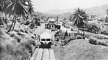
The Bog Walk to Port Antonio railway was a railway in Jamaica built to serve the banana, cacao, citrus and coconut districts of St Catherine, St Mary and Portland.
Construction, operation and closure
The railway operated from 1896 to 1978. It was temporarily closed from 1975 to 1977. The line was 54 miles (87 km) long.
Gradients
The ruling gradient was 1 in 63 with the line climbing approximately 550 feet (170 m) in 18 miles (29 km) (average gradient 1 in 173) from Bog Walk (approximately 250 feet (76 m)) to its summit at Highgate (approximately 800 feet (240 m)) then descending approximately 750 feet (230 m) in just 9 miles (14 km) (average gradient 1 in 63) to the Wag Water Bridge (just above sea level) and continuing for another 27 miles (43 km) more or less on the level and along the coast to Port Antonio.
Stations and Halts
There were 13 stations and 15 halts:
|
 |
Tunnels

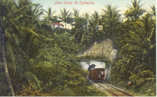
There were 17 tunnels:
| Tunnel | Approximate length |
|---|---|
| Riversdale | 150 metres (160 yards) |
| Harewood | 150 metres (160 yards) |
| Darling Spring | 200 metres (220 yards) |
| Cromwell Mountain #1 | 75 metres (82 yards) |
| Cromwell Mountain #2 | 270 metres (300 yards) |
| Cromwell Mountain #3 | 150 metres (160 yards) |
| Cromwell Mountain #4 | 100 metres (110 yards) |
| Cromwell Mountain #5 | 150 metres (160 yards) |
| Cromwell Mountain #6 | 200 metres (220 yards) |
| Cromwell Mountain #7 | 175 metres (191 yards) |
| Taja | 250 metres (270 yards) |
| Flint River | 250 metres (270 yards) |
| Richmond | 150 metres (160 yards) |
| Rock Hill | 150 metres (160 yards) |
| Hope Bay #1 | 225 metres (246 yards) |
| Hope Bay #2 | 50 metres (55 yards) |
| Hope Bay #3 | 100 metres (110 yards) |
Bridges
There were ten significant bridges. Approximate bridge lengths are shown in the route diagram to the right.
- B2 & River Doro at Darling Spring/Troja
- Orange River at Richmond
- Wagwater River
- Pencar River
- Dry River
- White River
- Buff Bay River
- Spanish River
- Swift River
- Rio Grande
Bibliography
- Satchell, Veront M & Sampson, Cezley (2003), The rise and fall of railways in Jamaica 1845-1975, The Journal of Transport History
See also
Notes and references
- Satchell & Sampson 2003, p. 6
- Satchell & Sampson 2003, p. 7
- Table 3.5 Mileage for JRC Stations, Halts & Sidings in relation to the Kingston Railway Terminus Archived March 15, 2013, at the Wayback Machine, Annual Transport Statistics Report: Jamaica in Figures 2003-2004, Ministry of Transport and Works, July 2005.
- ^ UK Directorate of Overseas Surveys 1:50,000 map of Jamaica Sheets K, L & M c1970.
- ^ Google satellite image resolution is at present insufficient to show this station/bridge.
- Bridge lengths were obtained using Wikimapia's GeoTools.