| This article needs additional citations for verification. Please help improve this article by adding citations to reliable sources. Unsourced material may be challenged and removed. Find sources: "Belá nad Cirochou" – news · newspapers · books · scholar · JSTOR (April 2022) (Learn how and when to remove this message) |
| Belá nad Cirochou | |
|---|---|
| Municipality | |
 | |
  | |
| Coordinates: 48°58′N 22°06′E / 48.967°N 22.100°E / 48.967; 22.100 | |
| Country | |
| Region | Prešov |
| District | Snina |
| First mentioned | 1451 |
| Area | |
| • Total | 17.34 km (6.70 sq mi) |
| Elevation | 211 m (692 ft) |
| Population | |
| • Total | 3,339 |
| Time zone | UTC+1 (CET) |
| • Summer (DST) | UTC+2 (CEST) |
| Postal code | 067 81 |
| Area code | +421 57 |
| Car plate | SV |
| Website | www |
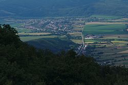
Belá nad Cirochou (Rusyn: Бела над Цірохов, Hungarian: Cirókabéla) is a large village and municipality in Snina District in the Prešov Region of north-eastern Slovakia.
History
In historical records the village was first mentioned in 1451. Before the establishment of independent Czechoslovakia in 1918, Belá nad Cirochou was part of Zemplén County within the Kingdom of Hungary. From 1939 to 1944, it was part of the Slovak Republic. In the autumn of 1944, the Red Army dislodged the Wehrmacht from Belá nad Cirochou and it was once again part of Czechoslovakia.
Geography
The municipality lies at an altitude of 207 metres and covers an area of 17.356 km. It has a population of about 3315 people.
Genealogical resources
The records for genealogical research are available at the state archive "Statny Archiv in Presov, Slovakia"
- Roman Catholic church records (births/marriages/deaths): 1786–1895 (parish B)
- Greek Catholic church records (births/marriages/deaths): 1825–1895 (parish B)
See also
References
- "Počet obyvateľov podľa pohlavia - obce (ročne)". www.statistics.sk (in Slovak). Statistical Office of the Slovak Republic. 2022-03-31. Retrieved 2022-03-31.
- ^ "Hustota obyvateľstva - obce [om7014rr_ukaz: Rozloha (Štvorcový meter)]". www.statistics.sk (in Slovak). Statistical Office of the Slovak Republic. 2022-03-31. Retrieved 2022-03-31.
- ^ "Základná charakteristika". www.statistics.sk (in Slovak). Statistical Office of the Slovak Republic. 2015-04-17. Retrieved 2022-03-31.
- ^ "Hustota obyvateľstva - obce". www.statistics.sk (in Slovak). Statistical Office of the Slovak Republic. 2022-03-31. Retrieved 2022-03-31.
External links
 Media related to Belá nad Cirochou at Wikimedia Commons
- Official website

- https://web.archive.org/web/20070427022352/http://www.statistics.sk/mosmis/eng/run.html
- Surnames of living people in Bela nad Cirochou
This Prešov Region geography article is a stub. You can help Misplaced Pages by expanding it. |